


Knowledge exchange
Short-term scientific missions (STSM) are exchange visits between participants involved in Sub-Urban, allowing e.g. scientists and city partners to visit an institution, laboratory or city partner in another participating country.
Knowledge exchange
Short-term scientific missions (STSM) are exchange visits between participants involved in Sub-Urban, allowing e.g. scientists and city partners to visit an institution, laboratory or city partner in another participating country.
Short-term scientific missions (STSM) are exchange visits between participants involved in a COST Action, allowing e.g. scientists and city partners to visit an institution, laboratory or city partner in another COST country. They are aimed at fostering collaboration, sharing new techniques and infrastructure that may not be available in other participants' institutions or laboratories. STSMs are intended especially for young researchers.
Sub-urban has completed a range of STSM's, the reports of which can be downloaded.
- Best practice for the monitoring and modelling of urban groundwater environments
- Review of Database Requirements to Support Ground Water and Integrated Modelling
- Management and access to subsurface data – lessons learnt from BSU Hamburg as a case study of best practice
- Urban typology for reviewing the state of the art in urban subsurface planning
- Delivery and impact of subsurface data in the absence of a comprehensive legislative framework – shared issues and difficulties in Odense and Glasgow
For further information on STSM's contact:
Johannes de Beer
MC Vice-Chair and STSM coordinator COST TU 1206 Sub-Urban
Norges geologiske undersøkelse
Postboks 6315 Sluppen
7491 Trondheim, Norge
E-mail: hans.debeer@ngu.no
1. BEST PRACTICE - GROUNDWATER
STSM Author: Stephanie Bricker (BGS, Edinburgh UK).
STSM Host: Renate Taugs (BSU, Hamburg DE).
Background image: Hamburg, by Thilo Hilberer, creative commons.
1. BEST PRACTICE - GROUNDWATER
STSM Author: Stephanie Bricker (BGS, Edinburgh UK).
STSM Host: Renate Taugs (BSU, Hamburg DE).
Background image: Hamburg, by Thilo Hilberer, creative commons.
Best practice for the monitoring and modelling of urban groundwater environments

The objective of the STSM was to gain an understanding of best practice urban hydrogeological/groundwater monitoring and modelling for policy-making. From initial data collection, evaluation and management, through to designing, installing and operating monitoring networks the aim of the STSM was to evaluate the best practice delivered by BSU Hamburg and consider relevant application within Glasgow and other UK cities.
2. REVIEW - DATABASE REQUIREMENTS FOR GROUNDWATER AND INTEGRATED MODELLING
STSM Author: Andrew Riddick (BGS, Nottingham UK)
STSM Hosts: Ingelöv Eriksson (City of Oslo, Agency for Planning and Building Services, Oslo, Norway) and Johannes de Beer (Geological Survey of Norway, Trondheim, Norway)
Background image: Database of the earth, by Maurizio Abbate, creative commons
REVIEW OF DATABASE REQUIREMENTS TO SUPPORT GROUND WATER AND INTEGRATED MODELLING
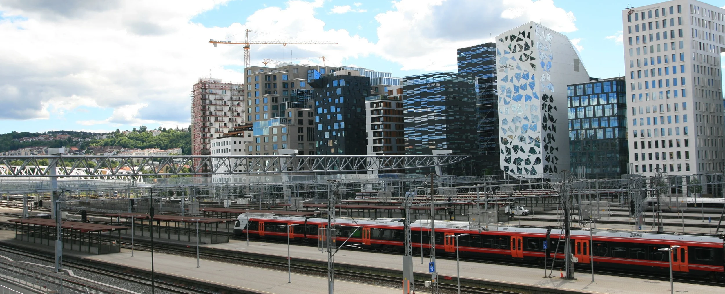
This report describes and documents activities undertaken as part of a Short Term Scientific Mission (STSM) visit to Norway forming part of the EU COST SUB-URBAN project. Visits were made to the City of Oslo department of Planning and Mapping Services, and also the Geological Survey of Norway over the period 24th-28th February 2014.
The STSM provided an opportunity to understand in detail the requirements of the City of Oslo for addressing various sub surface problems concerned with ground water flow and foundation stability. The NGU is aiming to develop modelling methodologies and workflows which can address problems of this kind. Within the STSM visit we focussed on some of the components and building blocks of this workflow, in terms of the underlying databases, and considering some software tools developed by BGS but which could be adapted for use by NGU and the City of Oslo. It is clear that there is much productive and useful work to be done "getting the foundations right" in terms of data, and that BGS can also learn from the application of these techniques in Norway. In particular we identified opportunities to test various BGS software tools (such as Platypus) with data from NGU and the City of Oslo, thus benefiting all three organisations.
A number of the problems outlined both in Oslo and more generally on Norwegian aquifer modelling would seem appropriate to be investigated by integrated environmental modelling (IEM) a technique which BGS is seeking to develop further by working with partner organisations to develop. Development of such fully integrated models would require more work on the development of databases and software tools to create 3D grids etc (which is discussed below). However, particular examples which could be worked on in future would be the interaction between groundwater flow and surface water in the Oslo City area, and in turn the effect on groundwater levels and foundation conditions. There also appear to be issues associated with localised aquifers which fall under NGU’s remit, for example understanding the interplay between fluvial flow and groundwater, and potentially climate associated with seasonal aquifer re- charge related to spring snow melt which could be better understood through integrated environmental models
3. SUBSURFACE DATA – LESSONS LEARNT FROM BSU HAMBURG
STSM Author: Helen Bonsor (BGS, Edinburgh UK).
STSM Host: Renate Taugs (BSU, Hamburg DE).
Background image: Hamburg, by Mariano Mantel, creative commons
3. SUBSURFACE DATA – LESSONS LEARNT FROM BSU HAMBURG
STSM Author: Helen Bonsor (BGS, Edinburgh UK).
STSM Host: Renate Taugs (BSU, Hamburg DE).
Background image: Hamburg, by Mariano Mantel, creative commons
MANAGEMENT AND ACCESS TO SUBSURFACE DATA – LESSONS LEARNT FROM BSU HAMBURG AS A CASE STUDY OF BEST PRACTICE
The aim and purpose of this STSM was to look at Hamburg as a best practice example of subsurface data management, and examine how the data are used to support groundwater management. A secondary aim of the STSM was to make a primarily assessment of how applicable the practices in Hamburg are to other COST cities such as Glasgow – where there is little groundwater data, and where there is lack of formal data management of subsurface data between the public and private sectors, making access and re-use of groundwater data for managing the resource very difficult.
BSU Hamburg provides a benchmark example to COST cities as to how subsurface data should be managed to support decision making within cities by both the public and private sectors.
Key messages from this STSM are:
- The accessibility of the Borehole and Groundwater datasets via the Data Portals within BSU means there is a high re-use of the data to support decision making, and assist environmental regulation.
- The accessibility of the subsurface datasets to all BSU departments, and the close working relationships between different BSU departments, means that the data are used consistently by different departments, and coherent and agreed conceptual models of the subsurface are used to support decision making.
- The strong inter-organisational working relationships developed by BSU with public and private sector organisations has taken many years, but it is instrumental to:
Developing comprehensive and standardised Borehole and Groundwater datasets for the city, which have enabled a strong understanding and coherent management of the subsurface by different organisations in the city.
Environmental and urban redevelopment decisions are made from the same data and 3D models, across different organisations.
Fostering a virtuous cycle of data and knowledge exchange between BSU and other public and private sector organisations in the city.
Standardisation and rationalisation of existing subsurface data, and groundwater monitoring are required in nearly all COST cities to meet key current urban redevelopment and groundwater management demands. The lessons learnt from the STSM are, therefore, of benefit to all COSTparticipants, and not just BGS and BSU Hamburg.
The feasibility of transferring the subsurface data management practiced in Hamburg to other COST cities is in part dependent on the different legislative frameworks existing in COST cities, and the different remits of geological surveys and city partners.
4. URBAN TYPOLOGY - URBAN SUBSURFACE PLANNING
STSM Author: Dr Michiel van der Meulen (TNO, NL).
STSM Host: Rubén Lois-González (University of Santiago de Compostela, ES).
Background image: Colville-Andersen, creative commons
4. URBAN TYPOLOGY - URBAN SUBSURFACE PLANNING
STSM Author: Dr Michiel van der Meulen (TNO, NL).
STSM Host: Rubén Lois-González (University of Santiago de Compostela, ES).
Background image: Colville-Andersen, creative commons
URBAN TYPOLOGY FOR REVIEWING THE STATE OF THE ART IN URBAN SUBSURFACE PLANNING

‘Geographically representative’ refers not only to the physical but also human geography of cities we consider: for any planning approach it makes a fundamental difference what size a city has, what the population is, whether it is prosperous or poor, isolated or not, etc. However, an urban typology that is applicable to our particular project is not readily available and should be conceived and agreed within the project. Establishing such typology is the first objective of the STSM, and the second one is to apply it and make a selection of cities to be included in the report of WP1.
5. SUBSURFACE LEGISLATIVE FRAMEWORK - ODENSE AND GLASGOW
STSM author: Helen Bonsor (BGS, Edinburgh UK).
STSM Host: Johan Linderberg (VCS, Odense), Susie Mielby (GEUS).
Background image: Odense, by Nelson L., creative commons
5. SUBSURFACE LEGISLATIVE FRAMEWORK - ODENSE AND GLASGOW
STSM author: Helen Bonsor (BGS, Edinburgh UK).
STSM Host: Johan Linderberg (VCS, Odense), Susie Mielby (GEUS).
Background image: Odense, by Nelson L., creative commons
DELIVERY AND IMPACT OF SUBSURFACE DATA IN THE ABSENCE OF A COMPREHENSIVE LEGISLATIVE FRAMEWORK – SHARED ISSUES AND DIFFICULTIES IN ODENSE AND GLASGOW

The purpose of the STSM was to facilitate knowledge exchange between specialists in VCS Odense, GEUS, Odense City Municipality and BGS to compare key issues of the subsurface data management within the cities of Glasgow and Odense, in the absence of a comprehensive legislative framework in the UK or Denmark which ensures all borehole data are submitted to national or local public authorities. The STSM also aimed to discuss methods which could be used to improve the delivery and impact of subsurface data within the cities, and which could be transferred as a best practice to other cities within the COST Action with similar legislation.
6. GOCAD® WORKSHOP
STSM AUTHOR: Mitja Janža, Geological Survey of Slovenia, Ljubljana, Slovenia
STSM HOSTs: Mike Mc Cormack & Dr Diarmad Campbell (BGS, Edinburgh, United Kingdom)
Background image: Stairs in Ljubljana castle, by Octanou, creative commons
6. GOCAD® WORKSHOP
STSM AUTHOR: Mitja Janža, Geological Survey of Slovenia, Ljubljana, Slovenia
STSM HOSTs: Mike Mc Cormack & Dr Diarmad Campbell (BGS, Edinburgh, United Kingdom)
Background image: Stairs in Ljubljana castle, by Octanou, creative commons
GOCAD® WORKSHOP

Source: GoCad.org
Geological Survey of Slovenia (GeoZS) has a long history of collecting geological data. But the potential of gathered data is far from being used. One of the important reasons for that is a low capability in upgrading data into information customised to the user (stakeholder) needs. There is a strong need for tools creating, exporting and visualizing the 3D geological models which could be further used as a geometric base for numerical 4D (e.g. groundwater flow) simulations. The area of our interest in this COST action ‐ the city of Ljubljana is characterised as tectonic depression, formed by tectonic subsidence and gradual filling by alluvial and lacustrine sediments. It is a complex geological situation and to maximise the use of geological information for city needs advanced procedures and tools are required.
GOCAD® software enables subsurface modelling for geological, geophysical and reservoir management purposes. It has been used by British Geological Survey (BGS) for the past decade for the construction of 3D geological models and as a data integration and visualisation platform. Exchange of knowledge and experiences on using the software would contribute to better use of geological data in urban planning procedures.
7. 3D GEOLOGICAL MODELS IN GOCAD
STSM AUTHOR: Beatriz Mozo Lopez (GSI, Dublin Ireland)
STSM HOST: MIKE MC CORMACK (BGS, EDINBURGH, UNITED KINGDOM)
Background Image: The Docklands of Dublin, by Tobias Abel, creative commons
7. 3D GEOLOGICAL MODELS IN GOCAD
STSM AUTHOR: Beatriz Mozo Lopez (GSI, Dublin Ireland)
STSM HOST: MIKE MC CORMACK (BGS, EDINBURGH, UNITED KINGDOM)
Background Image: The Docklands of Dublin, by Tobias Abel, creative commons
DATA PREPARATION, DATA MANAGEMENT, CREATION AND DELIVERY OF 3D GEOLOGICAL MODELS IN GOCAD
GSI has being a member of the GSI3D Research Consortium for the last few years and has being using GSI3D to create 3D models of the Quaternary of Dublin and Cork. When GSI attempted to model Bedrock using the same software it was clear that GSI3D wasn’t able to do it.
All those reasons in conjunction with the ceasing of the GSI3D Research Consortium in 2015 forced GSI to look for alternatives to continue with the 3D modelling.
Aim and purpose
The aim and purpose of this STSM was to learn the basics of 3D modelling and data delivery using Gocad in order for GSI to progress in the 3D modelling. As BGS has being using Gocad for many years and they have develop best practice and many 3D models, it felt right to propose this STSM in conjunction with them.
8. The subsurface: shared issues in hong kong and Glasgow
STSM AUTHOR: DR. S.D.G. CAMPBELL (BGS, EDINBURG, UK)
STSM HOST: MR. H.N. WONG, HEAD, GEOTECHNICAL ENGINEERING OFFICE, CIVIL ENGINEERING AND DEVELOPMENT DEPARTMENT, HONG KONG SAR GOVERNMENT (HK)
Background image: Hong Kong, by Kevin Jaako, creative commons
The subsurface in planning and decision-making - shared issues in hong kong and Glasgow
This Short-term Scientific Mission (STSM) was a contribution to COST Action TU1206 (Sub-Urban), and specifically between the British Geological Survey (UK) and the Geotechnical . of the current Working Group (WG) 1 city studies of the Action, and the reviews of good practice underway as part of WG2, by undertaking detailed assessments for both in Hong Kong. The subsurface is extensively exploited in Hong Kong, and there are very ambitious plans to expand its utilization, under the control of an advanced planning regime that takes considerable cognisance of the subsurface. The results contribute to: the reporting of WG1; have direct relevance to the subgroups of WG2, dealing with planning, data management and geohazards; and contribute to the Action's Toolbox (WG3).
The STSM facilitated an invaluable, focused period of knowledge exchange between BGS and Glasgow on the one hand, and GEO, DSD and PlanD in Hong Kong on the other, centred on key issues of subsurface planning and enhanced use of the urban subsurface. The lessons learnt within this STSM are of benefit to all COST-participants, and not just BGS, Glasgow, and GEO. It is hoped the work of the STSM can be built upon to engage a wider group of COST participants and cities to become involved in the discussions.
The work by, and various studies carried out for, the Geotechnical Engineering Office (GEO) of the Civil Engineering and Development Department (CEDD), Hong Kong SAR, and its sister government departments including Planning Department and Drainage Services Department, provide a benchmark example to COST city-partners and others to aspire to as to how the subsurface can be promoted, planned for in an integrated and sustainable way, and developed, especially in relation to the development of caverns intended for a wide range of uses.
The findings of the STSM are of considerable relevance, and applicability to COST Sub-Urban partners, and especially, but not exclusively, to its city-partners. These need to be promulgated widely therefore, to promote ‘best’ practice. The feasibility of transferring the subsurface planning culture and enhanced use of the subsurface as being practiced and implemented in Hong Kong to other COST cities will, however, be in part dependent on the different legislative frameworks existing in COST cities, and the different remits of city partners, and geological surveys. This will therefore require further discussion by COST Sub-Urban Working groups.
The STSM confirmed that the work being carried out by Glasgow City Council in Glasgow, with the support of the British geological Survey (BGS), to develop statutory guidance for planning of Glasgow’s subsurface, is following good practice. Visiting GEO/CEDD in Hong Kong, and other Hong Kong SAR departments, also gave a direct insight into the full potential of subsurface planning and enhanced use of the subsurface; something to aspire to on the basis of the work in Glasgow.
- As a follow up to the STSM, a city study for Hong Kong is being prepared as a contribution to the series of city studies being undertaken for Working Group 1 of COST Action TU1206 Sub-Urban. This will cover city typology (Appendices 1 and 2), geology (Appendix 1), and subsurface planning system (Appendix 3 etc.).
- The assessment of subsurface planning used in Hong Kong, and that being prepared for the next generation of the enhanced use of the urban subsurface, and associated cavern development in the Hong Kong SAR, will be provided as an exemplar of practice, to the Subsurface Planning Subgroup (WG2.1) of Working Group 2 of COST Action TU1206 Sub-Urban. This will be included in the toolbox to be prepared under Working Group 3 of the Action, for roll-out to city partners for testing, and wider roll-out in Europe and further afield.
- In return, two presentations have already been given to wider audiences than those specifically targeted as part of the STSM, to share knowledge and experience gained from Glasgow to Hong Kong practitioners, to:
- The GEO/CEDD in an open GEO Seminar on “Geological and geotechnical characterisation of the shallow urban subsurface for planning and development”
- The Hong Kong Regional Group of the Geological Society of London on “From geological maps to 3D and 4D models - transforming the delivery and relevance of geological knowledge for practitioners”
Download the full report in PDF format
9. Development of concepts for managing thermal resources in urban areas
STSM AUTHOR: DR. J. EPTING (DEPARTMENT OF ENVIRONMENTAL SCIENCES, UNIVERSITY OF BASEL, SWITZERLAND)
STSM HOST: PROF. VAZQUEZ-SUNE (CONSEJO SUPERIOR DE INVESTIGACIONES CIENTIFICAS, INSTITUTE OF ENVIRONMENTAL ASSESSMENT AND WATER RESEARCH, BARCELONA, SPAIN)
Background image: Barcelona, by Moyan Brenn, creative commons
Development of concepts for the management of thermal resources in urban areas
In urban areas the shallow subsurface often is used as a heat resource (so-called shallow geothermal energy), i.e. for the installation and operation of a broad variety of geothermal systems. At the same time, groundwater is increasingly used as a cheap cooling medium, e.g. for buildings. Further impacts like the so-called urban heat island effect also influence the thermal regime in the subsurface. As a result, significantly increased groundwater temperatures have been observed in many urban areas.
The cooperation partners propose the development of concepts and methods for the management of thermal resources in urban areas. For two selected case study cities in Basel (CH) and Zaragoza (S) already comprehensive monitoring networks (hydraulics and temperature) as well as calibrated high-resolution numerical heat-transport models have been developed by the individual collaboration partners (Epting et al. 2013; Epting and Huggenberger2013; Garcia Gil et al. 2014). This previous work showed that an understanding of the variable influences of hydraulic and thermal boundary conditions due to specific geological and hydrogeological conditions in urban settings is crucial. It also could be shown that good quality data are necessary to appropriately define and investigate thermal boundary conditions and the temperature development in urban systems.
The STSM involved several meetings with different scientist of the Institute of Environmental Assessment and Water Research (IDAE) that are involved in urban hydrogeological issues. Furthermore, a collective work effort has been carried out on the existing data-sets of Zaragoza and Basel and synthesize the different hydraulic and thermal boundary conditions for both groundwater bodies. The transferability of the applied methods will be discussed in the scientific community.
10. IMPLEMENTATION OF SUBSURFACE KNOWLEDGE IN URBAN PLANNING
STSM AUTHOR: P. VAN DER LUGT (CITY OF ROTTERDAM, THE NETHERLANDS)
STSM HOST: I. ERIKSSON (AGENCY FOR PLANNING AND BUILDING SERVICES, CITY OF OSLO, NORWAY)
Background image: Rotterdam harbour, by Moyan Brenn, creative commons
10. IMPLEMENTATION OF SUBSURFACE KNOWLEDGE IN URBAN PLANNING
STSM AUTHOR: P. VAN DER LUGT (CITY OF ROTTERDAM, THE NETHERLANDS)
STSM HOST: I. ERIKSSON (AGENCY FOR PLANNING AND BUILDING SERVICES, CITY OF OSLO, NORWAY)
Background image: Rotterdam harbour, by Moyan Brenn, creative commons
OSLO SUBSURFACE Project - Lessons and applications with particular reference to implementation of subsurface knowledge in Urban Planning in Rotterdam
The work on the Oslo Subsurface Project provides an ideal case study for the COST SUB-URBAN Action to learn from. This STSM has allowed for benchmarking between Oslo and Rotterdam to be set up as both cities are in an investigating stage of regulating and managing the underground and have challenges in enhancing awareness of the subsurface. The fact that the STSM is timed to run in parallel with a STSM between Oslo and Glasgow enhances the results to be beneficial to the COST Action.

Source: Stadsontwikkeling Rotterdam
The planning policy and process of enhancing the level of awareness of subsurface in city development in Glasgow and Oslo are of large interest to Rotterdam. This STSM has resulted in an exchange of knowledge between the three cities about how to raise the awareness of the importance of the urban subsurface among urban planners.
Many lessons have been learned through this STSM in relation to the following topics:
- municipal knowledge and responsibilities
- integration of the subsurface in spatial plans
- data and software used in the chain of urban planners and engineers
- road to integral consideration of subsurface data with above surface issues to optimise urban development
- communication between urban planners and engineers
- tools to enhance stakeholder involvement
- the role of institutional arrangements
Download the full report in pdf format.
11. OSLO SUBSURFACE PROJECT; LESSONS FOR URBAN PLANNING IN GLASGOW
STSM AUTHOR: G. DICK (GLASGOW CITY COUNCIL, UNITED KINGDOM)
STSM HOST: I. ERIKSSON (AGENCY FOR PLANNING AND BUILDING SERVICES, CITY OF OSLO, NORWAY)
Background image: Glasgow undergound, by Stuart Chalmers, creative commons
11. OSLO SUBSURFACE PROJECT; LESSONS FOR URBAN PLANNING IN GLASGOW
STSM AUTHOR: G. DICK (GLASGOW CITY COUNCIL, UNITED KINGDOM)
STSM HOST: I. ERIKSSON (AGENCY FOR PLANNING AND BUILDING SERVICES, CITY OF OSLO, NORWAY)
Background image: Glasgow undergound, by Stuart Chalmers, creative commons
The STSM involved a 5-day visit of 2 STSM applicants (Gillian Dick ,GCC and Petra van der Lugt, Gemeente Rotterdam) to Oslo Kommune from 9th - 13th February 2015. Meeting discussions over the week were centred on:
The work on the Oslo Sub Surface Project provides an ideal case study for the COST SUB-URBAN Action to learn from. This STSM will allow benchmarking between Oslo, Rotterdam and Glasgow to be set up as each City adapts its nationally setting urban planning legislation to allow it to plan for the subsurface.
The work and outputs of this STSM are of wide benefit to the COST Action and its participants, as well as to others outside of the Action, by:
- Facilitating knowledge exchange between key personnel in GCC, OK, GR to evaluate lessons learned from Oslo’s Sub Surface project and its links to urban planning and law.
- Compare the issues in adapting national urban planning legislation to allow for local and strategic planning of the subsurface
- Review the key drivers – knowledge, economic, political & environmental
- Provide a detailed case study that can be benchmarked against the activities in Rotterdam and Glasgow
- Provide the basis for engagement of a wider group of COST participants.
This STSM co-ordinates currently independent work between COST participants to allow a benchmarking process to be piloted between the three cities.
12. BRO: DUTCH NATIONAL REGISTER FOR SUBSURFACE DATA - LESSONS LEARNT
STSM AUTHOR: H.C. BONSOR (BRITISH GEOLOGICAL SURVEY, UNITED KINGDOM)
STSM HOST: M. VAN DER MEULEN (TNO, THE NETHERLANDS)
Background image: New Delft Underground Railway Station, 2015, by Hendrik Ploeger, creative commons
12. BRO: DUTCH NATIONAL REGISTER FOR SUBSURFACE DATA - LESSONS LEARNT
STSM AUTHOR: H.C. BONSOR (BRITISH GEOLOGICAL SURVEY, UNITED KINGDOM)
STSM HOST: M. VAN DER MEULEN (TNO, THE NETHERLANDS)
Background image: New Delft Underground Railway Station, 2015, by Hendrik Ploeger, creative commons
The establishment of national register for all subsurface data (BRO) within the Netherlands by TNO is a hugely significant body of work and forms a benchmark case study to COST Action TU1206 Sub-Urban in data management and use.
Animation of the Structural Vision of the Subsurface in the Netherlands (in Dutch). Source: http://www.rijksoverheid.nl/onderwerpen/bodem-en-ondergrond/ruimtelijke-ordening-ondergrond
lncreased standardisation of subsurface data is required in nearly all COST cities and countries to increase the accessibility and re-use of subsurface data, and to maximise the collective potential value and past investment in these data. The urban subsurface is being increasingly utilised for infrastructure as well as energy and water abstraction, and there is growing recognition of the need for urban planning to be three-dimensional with guidelines for the subsurface. In tandem with this, uncertainty in ground conditions due to limited accessibility of ground information, remains one of the biggest sources of project overspends to the construction industry and overly conservative design in many countries. Poor data accessibility is also a significant constraint to development of 3Dsubsurface models to improve site investigation design and inform urban development.
This STSM allowed knowledge exchange between key personnel in BGS and TNO to evaluate the key lessons learnt from the implementation of BRO, and their applicability to other countries to achieve increased standardisation of data and better data capture. The discussions and lessons learnt from implementing BRO in the Netherlands are directly relevant to the current GSPEC pilot by the BGS in the UK to try and enforce submission of all subsurface data to a national BGS data repository, using a standardised digital data formatting format, to improve subsurface data accessibility and re-use in the UK. The STSM outputs are of immediate benefit to the Working Group 2 sub-group reviewing and identifying best practice in subsurface data management across Europe, but the evaluations and outputs of the STSM are highly relevant to the wider network of COST Action TU1206, Sub-Urban.
13. DEVELOPMENTS OF CONCEPTS FOR MANAGING THERMAL RESOURCES IN URBAN AREAS II
STSM AUTHOR: A. GARCIA-GIL (INSTITUTE OF ENVIRONMENTAL ASSESSMENT AND WATER RESEARCH ( IDÆA), CONSEJO SUPERIOR DE INVESTIGACIONES (CSIC), BARCELONA, SPAIN)
STSM HOST: PROF. P. HUGGENBERGER (DEP. OF ENVIRONMENTAL SICIENCES, UNIVERSITY OF BASEL, SWITZERLAND)
Background image: Rhine in Basel II by Tambako The Jaguar, creative commons
In urban areas the shallow subsurface often is used as a heat resource (so-called shallow geothermal energy), i.e. for the installation and operation of a broad variety of geothermal systems. At the same time, groundwater is increasingly used as a cheap cooling medium, e.g. for buildings. Further impacts like the so-called urban heat island effect also influence the thermal regime in the subsurface. As a result, significantly increased groundwater temperatures have been observed in many urban areas.
This STSM has been a follow-up on a previous STSM by Dr. Jannis Epting to Barcelona, in order to further exploit 2 case study cities (Basel (CH) and Zaragosa (S). Based on these studies, concepts for the management of thermal resources in urban areas have been derived and the transferability of the applied methods to other urban areas is discussed. For both cities, already comprehensive monitor-ing networks (hydraulics and temperature) as well as calibrated high-resolution numerical heat-transport models have been developed by the individual collaboration partners (Epting et al. 2013; Epting and Huggenberger2013; Garcia Gil et al. 2014). This previous work showed that an understanding of the variable influences of hydraulic and thermal boundary conditions due to specific geological and hydrogeological conditions in urban settings is crucial. It also could be shown that good quality data are necessary to appropriately define and investigate thermal boundary conditions and the temperature development in urban systems.
14. COST SAVINGS IN URBAN SUBSURFACE PLANNING
STSM AUTHOR: DR. T. COMPERNOLLE (HASSELT UNIVERSITY, BELGIUM)
STSM HOST: G. DICK (GLASGOW CITY COUNCIL, UNITED KINGDOM)
Background image: Hordaland Fylkeskommune
14. COST SAVINGS IN URBAN SUBSURFACE PLANNING
STSM AUTHOR: DR. T. COMPERNOLLE (HASSELT UNIVERSITY, BELGIUM)
STSM HOST: G. DICK (GLASGOW CITY COUNCIL, UNITED KINGDOM)
Background image: Hordaland Fylkeskommune
Considering that one of the main objectives of COST Action TU1206 Sub-Urban is to highlight the importance of introducing geological maps and subsurface information in urban planning activities, it is imperative that those operating at the planning level (decision makers, planners, developers, contactors, etc.) understand this importance, and the influence that geology has in planning, and the cost-benefits on using subsurface data more effectively in the planning process is evaluated.
To determine the value of geological information, a cost benefit analysis (CBA) can be performed. The value, or net benefit of subsurface information (SI) is equal to the benefit of using subsurface information minus the cost to obtain, collect, and use this information: 𝑉(𝐺𝐼)=𝑁𝐵(𝑆𝐼)=𝐵(𝑆𝐼)−𝐶(𝑆𝐼).
With 𝑉(𝑆𝐼) representing the value (or net benefit) of geological information, 𝐵(𝑆𝐼) the benefit of using geological information and 𝐶(𝑆𝐼) the cost of geological information. The purpose of this STSM was to trial the application of a cost-benefit analysis of subsurface data to Glasgow.
To value the benefit of geological data to reduce risks and uncertainties in development work, it is necessary to know the risks and associated costs of large projects that affected by taking into account geological information, and the risks and associated costs of these projects without taking into account geological information. The difference between these two costs can be considered as the benefit of using geological information. The costs of using geological information include the costs to obtain, collect, manage, consult, and use subsurface information. To determine who is willing to pay for subsurface information, it is necessary to know who is responsible at the different stages of the planning process for different actions, within the Action Programme of a site, and where the risk resides, if an unexpected and unwanted event occurs.
Analogously, a cost benefit analysis can be made to value the functions of the subsurface by comparing the cost and benefits of having and not having the subsurface to deliver that function.
This STSM has developed a methodological framework to assess the economic value of subsurface information. There is a clear immediate benefit of the STSM outputs to Working Group 2 subgroup reviewing and identifying best practice in Urban Planning and management across Europe. The evaluations and outputs of the STSM are highly relevant to COST Action TU1206 Sub-Urban as a whole.
15. LINKING ABOVE- AND BELOW GROUND DOMAINS
STSM AUTHOR: DR. J. SCHOKKER (GEOLOGICAL SURVEY OF THE NETHERLANDS, THE NETHERLANDS)
STSM HOST: S. MIELBY (GEOLOGICAL SURVEY OF DENMARK AND GREENLAND, DENMARK)
Background image: Mielby et al (2016)
15. LINKING ABOVE- AND BELOW GROUND DOMAINS
STSM AUTHOR: DR. J. SCHOKKER (GEOLOGICAL SURVEY OF THE NETHERLANDS, THE NETHERLANDS)
STSM HOST: S. MIELBY (GEOLOGICAL SURVEY OF DENMARK AND GREENLAND, DENMARK)
Background image: Mielby et al (2016)
This report describes the results of STSM TU1206-36204. During a visit to GEUS (DK) between 23 and 27 January 2017, Jeroen Schokker (TNO-GSN, NL) has focussed on the modelling of man-made ground as a linking pin between the above- and below-ground urban domains. Key results include:
- Man-made ground is all-inclusive and its definition and modelling should encompass everything that is present between the land surface and the natural subsurface that is of influence to the model properties at the intended use scale of the model. This means not only reworked natural deposits and artificial deposits, but, if present, also tunnels, cables, foundations, basements and archaeological heritage.
- The types of input data that are eventually used should be dependent on the modelling purpose and the associated modelling scale, but are in practice also determined by the data that can be made available and the project means to do so, as well as by the modelling method applied. The use of, preferably nation-wide, standardised publically available datasets is advised.
- Man-made ground modelling may be used to bridge the scale and information gap between above-surface information and natural subsurface information. Combination of these layers or submodels within one model (cf. GeoCIM approach) results in nesting of different model scales, both laterally and vertically.
- The ideas and technical solutions for efficient model maintenance are there. It is of prime importance that all parties involved acknowledge the need to keep models up-to-date to preserve their value. This requires maintenance funding and a feedback loop to report back model issues. Maintenance and update ask for sustainable relationships between cities and companies and/or institutes.