Publications
All products that are disseminated through the COST action TU 1206 Sub-Urban are available here.
All products that are disseminated through the COST action TU 1206 Sub-Urban are available here.
All products that are disseminated through the COST action TU 1206 Sub-Urban are available here.

The rapid growth of urban areas, and the constant development of city infrastructure, necessitates better understanding of the underground space. Across Europe, the urban subsurface is usually taken into consideration in the planning process, but awareness of the importance of knowledge about the geotechnical data and geohazards among city planners and stakeholders, still needs to be increased. This includes the need for a greater consideration of the subsurface information in the City Master plans, if geological and geotechnical problems are to be anticipated, and more realistic construction timeframes and budgets are to be developed.
Report
In the presented report the main goal was to emphasize the geotechnical data and geohazards importance in the city subsurface management. The report summarizes in sections 1-4 the issue of geotechnical databases, geotechnical data availability and geotechnical data exchange frameworks using selected best practices provides by COST Sub-Urban Action Members. Section 5 is focused on geohazards in the urban environment and their importance in the city planning process.
The report addresses geotechnical databases, models and geohazard inventories in relation to urban planning and management of the urban subsurface. The main questions and knowledge gaps that are flagged in the report include:
• How to increase the awareness among city planners and stakeholders of the importance of geotechnical modelling and geohazards inventories
• How to incorporate geotechnical modelling and geohazards data into the early stages of spatial planning
• How to encourage private companies to share their geotechnical data with Geological Surveys and municipalities and public organizations in between themselves Legal enforcement may be one option, but cooperation may be equally effective or even preferable (cf. ASK Network)
• What framework/standard should be the best for the integration of 2D/3D geotechnical models (site specific) within the city-scale 3D models
The report provides an overview of geotechnical databases, which are a key to effective parameterising of 3D models. As geological 3D models contain basic geological information on lithology, more pertinent parameterisation is needed in order to influence construction-related decision-making. This requires access to a range of geotechnical data. Both physical and mechanical parameters from the geotechnical databases can be used for 3D model parameterisation. Key parameters include: bulk density, moisture content, grains size distribution, friction angle and cohesion, oedometric modulus, etc... Such parameterised models can help to fill the gap between city scale data (1:10 000), which provides the geotechnical component to sites, and site-specific data (1:500). Spatial planning and feasibility studies for new large construction projects should use such parameterised 3D models as a starting point in their geological risk assessment and planning of site investigation.
Also, it is necessary to allow the implementation of geohazards risk assessment and mapping on a city scale. A multi-hazard and multi-risk approach is needed. All types of natural hazards should be analysed and identified. The list and the examples of geohazards (landslides, land subsidence) are presented in section 5 of the report. Click link for report: TU1206_WG25_006
“The vision is for Future Cities that live sustainably and in harmony with the ground they are built on. Relevant policy at local, national and trans-national scales will be needed to support this.» Dr. Diarmad Campbell, Chair of COST Action TU 1206 Sub-Urban, BGS.
TU1206-WG2.0-001 Opening up the subsurface for the cities of tomorrow
The subsurface is an important constituent of the physical environment of cities. We live on top of it; building and construction have to deal with the structure and properties of the subsurface, and occasionally with the hazards it presents; and we benefit from, and in some cases are dependent, on many of its ecosystem services. Cities not only expand outward and upward, but also downward. More and more, subsurface space is being used to relieve the increasingly crowded and congested urban surface. The more use we make of subsurface space, the more surface space we free up for the one function that cannot do without daylight and fresh air: living.
Read the Summary report TU1206-WG2.0-001 Opening up the subsurface for the cities of tomorrow.
Read the TU1206-WG2.2-003 Data Acquisition & Management report here
City authorities and other stakeholders in urban environments produce and have access to a greater density of data than is often the case in lesser populated areas, however, it is often very difficult to collate all relevant information together in a useful and easily communicated manner. With such a wide spectrum of stakeholder groups, each with specialist requirements and differing levels of knowledge, it is extremely challenging to provide effective communication tools that disseminate geoscience data and models as useable information. Information about the subsurface needs to be made available in ways which are appropriate to each type of consumer, from a geotechnical engineer carrying out a site investigation to a member of the public wanting to know if their house is at risk of flooding.
Read more from the report TU1206-WG2.2-003 Data Acquisition & Management report
the result of COST Action TU1206 Working Group 2, Work package 2.3, and focusses on 3D urban subsurface modelling and visualisation. The major aims of this report are: 1) evaluating current techniques and identify good practices / best efforts in 3D geological modelling and visualisation of the urban subsurface, based on case studies, and 2) co-developing (subsurface specialists & model users) requirements for optimal use of 3D geological modelling information in specific planning and policy contexts.
Read the report: 3D urban subsurface modelling and visualisation - a review of good practices and techniques to ensure optimal use of geological information in urban planning TU1206 WG2.3-004
Down load the report TU1206-WG2.4-005 Groundwater, Geothermal modelling and monitoring at city scale
The need for cities to make more effective use of the subsurface on which they stand, is increasingly being recognised in Europe and further afield to be essential for future cities to be sustainable and more resilient [1,2]. However, city planning worldwide remains largely 2D, with very few cities having any substantial subsurface planning or Masterplans – the cities of Helsinki, Montreal, Singapore being rare exceptions [3,4]. The consequences of inadequate consideration and planning of the subsurface are far-reaching, in economic, environmental and social terms. Across Europe, poor understanding of ground conditions is recognised as the largest single cause of construction project delay and overspends [5]. Management of urban groundwater and shallow geothermal energy resources is becoming increasingly important as cities are increasingly looking to use these resources to meet current and future energy and heating and water needs. Whilst these are, alongside potential underground building space, the two most important resources for future cities, the monitoring and regulation of these resource is widely variable across Europe.
Read the Sub-urban geochemistry report TU1206-WG2.6-007
The main need of city planners in relation to the geochemical quality of soils and subsoils is to have reasonable and representative visualisation of the data in a form, which enables them to be used effectively, and in an integrated way with other datasets (socio-economic, health, etc.).
A review of good practices in cultural heritage management and the use of subsurface knowledge in urban areas
City growth threatens sustainable development - a pattern of growth in which resource use aims to meet human needs while preserving the environment for present and future generations (The Brundtland Commision, 1987) - of cities. Over the past decades increased urbanization has created more pressure - not only on the suburban outskirts - but also in the inner core of the cities, putting important environmental issues, such as water management and cultural heritage, under stress.
Read more about Cultural heritage in report TU1206-WG2.7-007 Cultural heritage
Cities that are partners in this Sub-Urban group has made a Case Study of their city are presented here. The list will continuously be updated.
The subsurface is an important constituent of the physical environment of cities. We live on top of it; building and construction have to deal with the structure and properties of the subsurface, and occasionally with the hazards it presents. Cities not only expand outward and upward, but also downward. More and more, subsurface space is used to relieve the increasingly crowded and congested urban surface, especially for networks (metros, tunnels, cables, sewage, drainage), storage (warehouses, cellars, parking lots, thermal energy), and exotic applications such as shelter and protection (nuclear bunkers, bank vaults, underground passageways in cities with harsh climates). The more use we make of subsurface space, the more surface space we free for the one function that cannot do without daylight and fresh air: living.
In addition to the concrete results, COST Action Sub-Urban is successful in creating a community of practice between the geoscience and the planning communities, involving cities, universities and institutes. To some extent, the project is already improving the conditions for urban subsurface planning, especially where communication, mutual understanding and awareness raising are concerned. For better impact, however, this will have to be extended to decision makers and the general public.
Keywords
City; urban planning; urban geology; subsurface; A Coruña; Bergen; Dublin; Glasgow; Hamburg; Helsinki; Ljubljana; Nantes; Novi Sad; Odense; Oslo; Rotterdam; Europe
Read the summary report TU1206-WG1-001 Out of sight out of mind?
The Basel region, which borders both Germany and France, is one of the most dynamic economic regions in Switzerland and acts as a vital regional as well as interregional traffic junction. Moreover, Basel has a variety of natural environments as well as highly vulnerable groundwater systems in river valleys and adjacent karstified areas. Environmental changes include the development of subsurface infrastructure (e.g., tunnel highways) and urban subsurface structures in general which permanently impact groundwater flow and thermal regimes. The existence of evaporites and mixtures of marl-bearing evaporites in the Triassic formations as well as the fact that Basel is located in the seismologically most active area of central Europe come along with the potential occurrence of geohazards. Some of these hazards are natural whereas others are triggered by human activities.
Read more in the City case study of Basel in report TU1206 WG1-017
In this report the case studies for Bergen city, western Norway, are described. We are presenting facts about the city, the administration and the role of responsibility in the municipality with respect to planning and decision making. Furtheron the physical geography and geology of Bergen city area is described, providing the basis for the problems addressed in the case study of Bryggen in Bergen (ca. 2000-2015) and the newly started case study of the medieval city of Bergen, including Vågsbunnen and its appurtenant issues.
Here, the main emphasis is on describing the background of the ongoing sub-urban project in Bergen and the success story of Bryggen in Bergen. The issues to address in the future work are numerous. Laws and regulations will be evaluated during and because of this work. The aim is to build knowledge about the subsurface, to emphasise its role in urban planning and to develop a communication of data that is accessible for all parties who play a role in planning the urban area.
Read more in the City case study of Bergen in report TU1206-WG1-003
Dublin is Ireland’s capital and largest city with a population of 527,612 (2011) and it lies on the East coast of the Ireland (Fig1). The Dublin metropolitan area is Ireland’s financial and administrative centre. Dublin is the hub of Ireland’s transportation networks and a key gateway for international trade via air and sea. The Republic of Ireland has a total population of c. 4,588,000 and of that population c. 1,273,000 live in Co. Dublin making it the most densely populated part of the country.
Read more in the City case study of Dublin in report TU1206-WG1-004
Glasgow, Scotland’s largest city, lies along the River Clyde and its estuary in west central Scotland (Figure 1). The city grew rapidly in the 19th century, developing through industrialisation and trade to become the third largest city in Europe by the early 20th century. However, during the latter half of
the 20th century a decline in heavy industries such as ship building and mining led to population decline, dereliction of land and social deprivation. Since the early 1980’s, regeneration, restructuring and development have promoted an economic revival of the City. Regeneration of Glasgow’s economy, environment and social fabric through the promotion of sustainable development, social renewal and improvements in health continue to underpin the planning strategies for the development of the City.
Read more in the City case study of Glasgow in report TU1206-WG1-005
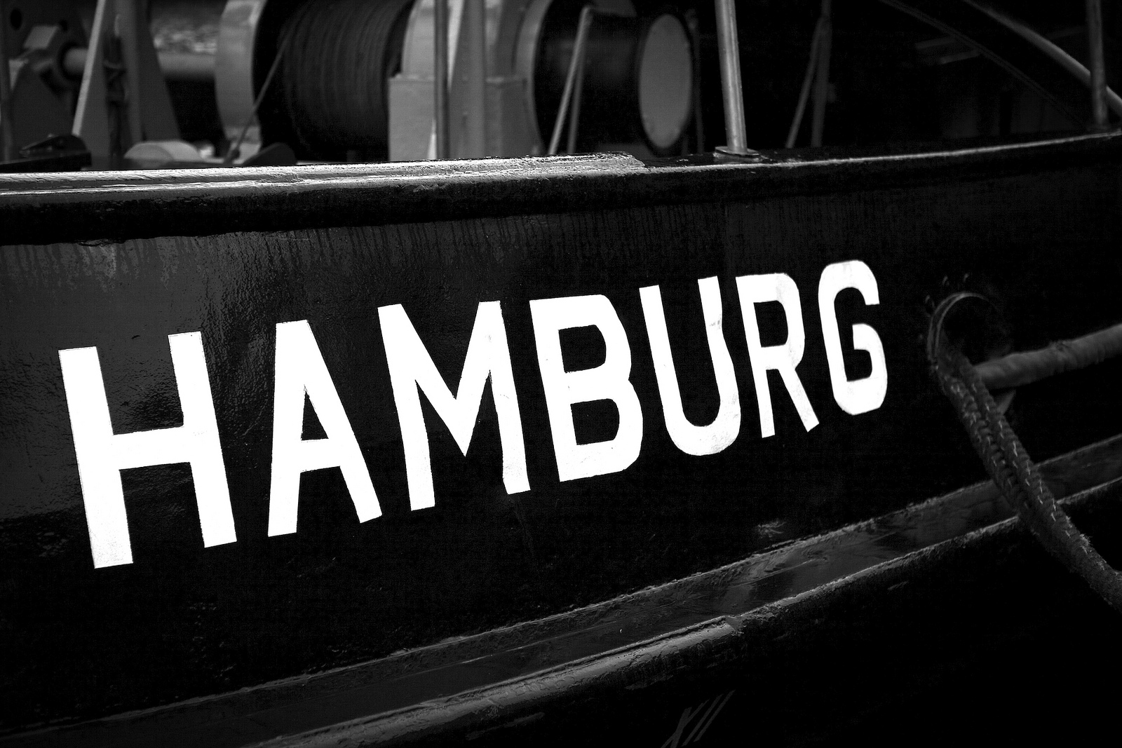
Article 1 of the Water Framework Directive (WFD) lists as one of its purposes a contribution to “the provision of the sufficient supply of good quality surface water and groundwater as needed for sustainable, balanced and equitable water use “, as well as “a significant reduction in pollution of groundwater …”. Thus, in the light of the Directive, mapping of groundwater bodies as well as the assessment of water quality is crucial for the drinkingwater
supply in the City of Hamburg.
This case study wants to provide a picture of geological, hydrogeological and modelling data in Hamburg and the established workflow between BSU Geological Survey, BSU Water Management department and Hamburg Water, the state-owned public water supply company of Hamburg.
Read more in the City case study of Bergen in report TU1206-WG1-006
City of Helsinki is the capital of Finland and one of the most densely populated areas in the country. Together with its surroundings it's called Greater Helsinki. It consists of metropolitan area including smaller urban Capital Region and commuter towns. These regions are located in the southern part of Finland, on the northern coast of the Gulf of Finland (Figure 1). The Capital region includes cities of Helsinki, Vantaa, Espoo, and Kauniainen (Figure 2) and has a population of about one million.
Read more in the City case study of Helsinki in report TU1206-WG1-007
Lisbon, Western Europe’s oldest city is the capital of Portugal, the major touristic and economic center and has a very densely occupation. However if we analyze its history we see that the ancient occupation of the Lisbon territory was limited to a central core, benefiting from the privileged and strategic position along Tagus River as well as the rugged morphology that has provided natural conditions for the city defense over the centuries.
Many of the city’s buildings are centuries old, and infrastructure is likewise aging and though the city has strong technical expertise and political will to undertake upgrades, it also faces financial constraints from the global economic crisis.
The lack of space led to the expansion of the city to the suburbs as well as to the occupation of less favorable terrains, leading to cost increases.
The solution was the construction in the consolidated city, in height and depth, namely to promote better conditions to inhabitants (basements, underground parking and subway tunnels). However this implies detailed knowledge about subsurface characteristics, which was gathered through survey campaigns. Using this information Lisbon Municipality has been developing a geotechnical database to generate a 3D geological/geotechnical model, aiming cost reduction and new projects optimization.
Read more in the City case study of Lisbon in report TU1206-WG1-015
Ljubljana is the capital and largest city of Slovenia, population 282,994 (2012) with an area of 10,000 m2. It has a central geographic location within Slovenia. Green areas from the hinterland extend into the historical city centre via green wedges and riparian corridors giving Ljubljana its distinctly green identity.
From geological point of view is the area of Ljubljana part of Ljubljana Basin - tectonic depression, formed by tectonic subsidence and gradual filling with alluvial and lacustrine sediments. The sediments are composed of well permeable gravel and sand beds with lenses of conglomerate. Due to the great thickness and good permeability, this sandy-gravel aquifer contains significant quantities of groundwater which is main resource, exploited for the public water supply of the city Ljubljana mostly without any treatment.
The city’s main development objectives are defined in the Municipal Spatial Plan (2010). City development is directed mainly at regeneration and renewal of existing developed areas and is also committed to resolving issues concerning safeguarding and development of green and open spaces. The most important objectives are to safeguard and manage the five green wedges in the city that link the city centre to the hinterland.
Read more in the City case study of Ljubljana in report TU1206-WG1-008
Nantes is the France’s sixth largest city. The conurbation (Nantes Métropole) comprises 600,000 inhabitants, and should reach the 700,000 mark by 2030. The Loire River, and the closeness of the Atlantic coast played a key role in the city's history and development. In the past, the economy was driven by the city's shipyards and maritime industry. Today, the city's industry and economy have undergone profound transformations that have provided an opportunity to redevelop large urban areas, especially in former industrial sites like in the Ile de Nantes, while protecting the fragile eco-systems of the Loire estuary.
Read the City case study of Nantes in report TU1206-WG1-009
The Novi Sad territory has been inhabited by humans since the Stone Age (about 4500 BC). A settlement was located on the right bank of the river Danube in the territory of present-day Petrovaradin. In antiquity, the region was inhabited by Illyrian, Thracian and Celtic tribes, especially by the Scordisci. Celts were present in the area already in the 4th century BC and founded the first fortress on the right bank of the Danube. Later, in the 1st century BC, the region was conquered by the Romans. During Roman rule, a larger fortress was built in the 1st century (Cusum) and was included in the Roman province of Pannonia.
Read more in the City case study of Novi Sad in report TU1206-WG1-010
The City of Odense is under big pressure – from above: because annual mean precipitation has increased by around 100 mm since measurements started 140 years ago. In addition, extreme rainfall events are occurring more often and are becoming more intense. There is also pressure from surface water: because of flooding due to extreme runoff in the rivers through the city or flooding from the Odense Fjord. Sometimes both types of flooding occur
at the same time. Thirdly, there is pressure from the subsurface: due to a rise in groundwater level caused by increased recharge, diminishing needs for potable water / lesser water abstraction and the sealing of previous leaky sewers which hereby stop acting as drains.
Read more in the City case study of Odense in report TU1206-WG1-011
Oslo is the capital of Norway. It is a small town by global standards, but still a rapidly growing city. The population of Oslo is the fastest growing in Europe, a tendency giving both challenges and opportunities. The city will require large investments in communication systems, new dwellings and an integrated land use and transportation planning. Underground space is already widely used for transportation, storage, extraction of heat and for foundations of buildings and infrastructure. Due to the rapid growth of the city the underground use is expected to develop further. The city of Oslo also deals with geological
challenges such as deep horizons of organic-rich clay, quick clays and alum shales that
contain enhanced levels of radium and uranium.
Read more in the City case study of Oslo in report TU1206-WG1-012
Rotterdam is located in the western part of the Netherlands in the province of Zuid-Holland. Most of the country’s surface is flat and cultivated, and present-day sedimentation and erosion processes are almost everywhere influenced by man: rivers are contained within dikes and many streams are canalized;
swamps, lakes and large parts of an inland sea have been turned into polders and in many places dikes strengthen the coastline. Without dikes nearly the whole western part of the country would be flooded. To keep the reclaimed polder areas dry and fit for farming, pumping stations – formerly windmills – extract water continuously and transfer it to bordering water bodies. As a drawback, water extraction leads to compaction of soft soils and oxidation of shallow peat layers, resulting in a gradual lowering of the land surface.
Read more in the City case study of Rotterdam in report TU1206-WG1-013
Valletta is the capital city of Malta and serves as a governmental, a business and an administrative hub of the Maltese Islands. This fortified city is located between the Grand Harbour and Marsamxett Harbour. It includes numerous monuments and buildings which date back the 16th, 17th and 18th centuries and which make Valletta a UNESCO World Heritage site. Amongst various monuments, the city has an extensive network of spaces below its surface. Most of these underground spaces were developed throughout the years for military and defensive purposes. However, the subterranean of Valletta has not been fully explored and requires further research, documentation and exposure.
Read more in the City case study of Valletta in report TU1206-WG1-016
Vienna is the capital of Austria and its cultural, economic and political centre. It is composed of 23 districts. Famous for its classical music, classicist and modern architecture, Art Nouveau buildings, imperial palaces, the State Opera, theatres, the traditional Viennese coffee houses and the Lipizzaner horses, Vienna attracts up to 6 million tourists per year. It is the home of over 100 museums and 13 universities as well as the seat of several United Nations offices (e.g. OSCE, OPEC, UNIDO and IAEA). According to the statistics of the International Congress and Convention Association, Vienna is the second most popular congress location worldwide, hosting up to 200 international conferences annually. Regarding life quality, the city was ranked as the second most liveable city worldwide in several 2015 surveys. As a global smart city, it reached third place among European cities in a 2014 ranking.
Read more in the City case study of Vienna in report TU1206-WG1-014
Short-term scientific missions (STSM) are exchange visits between participants involved in Sub-Urban, allowing e.g. scientists and city partners to visit an institution, laboratory or city partner in another participating country. Each STSM has resulted in a short scientific report. Click on the images to download the reports directly.
Short-term scientific missions (STSM) are exchange visits between participants involved in Sub-Urban, allowing e.g. scientists and city partners to visit an institution, laboratory or city partner in another participating country. Each STSM has resulted in a short scientific report. Click on the images to download the reports directly.

Geschreven door Floris Boogaard (Hanzehogeschool Groningen, Hogeschool Rotterdam, Tauw), Rick Heikoop, Kaj van de Sandt, Tijmen den Oudendammer (Hogeschool Rotterdam), Arjen Oostra (gemeente Rotterdam). op 25 januari 2018.
De ‘internationale city climatescan’ is een nieuwe methode om bewustwording te creëren over klimaatadaptatie. Hierbij worden de huidige status van klimaatadaptatie in een stad en de ambitie voor de komende jaren vastgelegd. . De climatescan heeft veel waardevolle informatie opgeleverd en zal daarom in de nabije geïmplementeerd worden in onder andere Nederland, Polen, Indonesië en de Filipijnen.
Read the article here: https://www.h2owaternetwerk.nl/vakartikelen/1664-internationale-city-climatescan-rotterdam-voorbeeld-infiltratie-in-het-stedelijk-gebied
Urban Subsurface Planning and Management Week, SUB-URBAN 2017, 13-16 March 2017, Bucharest, Romania. Volume 209, Pages 1–224 (2017)
Edited by Constantin Radu Gogu, Diarmad Campbell, Johannes de Beer. Complete proceedings is available here: http://www.sciencedirect.com/journal/procedia-engineering/vol/209/suppl/C
By Constantin Radu Gogu, Diarmad Campbell, Johannes de Beer (2017). Procedia Engineering 209 (2017) 1–3.
With the growing global population and increasing urbanization worldwide, sustainable urban development is now one of the greatest challenges faced by the modern world. This is acknowledged in the United Nations’ Sustainable Development Goals (SDGs) for "Transforming our world: the 2030 Agenda for Sustainable Development". Of the 17 "Global Goals", Goal 11 is Sustainable Cities and Communities, and Goal 6 is the related Clean Water and Sanitation
Goal. Despite these goals, the potential importance, and contribution, of the subsurface to sustainable urban development, and clean water and sanitation, is often unrecognized, or misunderstood, and at worst ignored.
Most cities around the world face issues related to geology and urban hydrogeology in particular, requiring attention at least as much as those provided by other planning related problems in urban areas. Currently, European cities face many consequences resulting from a lack of accurate and detailed knowledge of the underground environment and the interaction between the urban groundwater and urban infrastructure. These are core themes of this Special Issue.
The papers in this Special Issue emanate from the “Urban Subsurface Planning and Management Week” – SUBURBAN 2017 - held in Bucharest, Romania from the 13 to 16 March 2017 and hosted by the Groundwater Engineering Research Center of the Technical University of Civil Engineering, Bucharest, Romania.
Download paper: The Urban Subsurface – from Geoscience and Engineering to Spatial Planning and Management
By Diarmad Campbell, Johannes de Beer, Susie Mielby, Ignace van Campenhout, Michiel van der Meulen, Ingelöv Erikkson, Guri Ganerod, David Lawrence, Mario Bacic, Alex Donald, Constantin Radu Gogu, Jan Jelenek. Procedia Engineering 209 (2017) 4–11
The European COST Sub-Urban Action (TU1206) has had the fundamental aim of closing the knowledge gap between subsurface experts and potential users of subsurface knowledge - urban decision- makers, practitioners and researchers. The Action assembled a network involving >30 countries, 23 actively participating cities, researchers, practitioners and urban decision-makers, and brought together the fragmented research and good practice across Europe in sustainable urban sub-surface use. Development of national exemplars has been encouraged, and good practice identified to inspire others, using a lighthouse-follower approach to cascade knowledge and good practice across Europe and further afield.
Experts from both sides of the knowledge gap were brought together to assess and synthesise the state-of-the-art in lighthouse cities with respect to urban sub-surface knowledge, understanding, and use of that knowledge. This was achieved in 19 City Studies, with findings encapsulated in an over-view report “Out of Sight - Out of Mind”.
Download paper: Transforming the relationships between geoscientists and urban decision-makers: European COST Sub-Urban Action (TU1206)
By Susie Mielby, Ingelöv Eriksson, S. Diarmad G. Campbell, David Lawrence. Procedia Engineering 209 (2017) 12–25
COST (European Cooperation in Science and Technology) Action TU1206 Sub-Urban has explored sustainable use and management of the urban subsurface, and the use of subsurface information in urban planning and development. A part of the Action (Working Group 1) has assessed the ‘state-of-art’ in cities; another part (Working Group 2) has evaluated practices and techniques. Both have considered access to subsurface knowledge in cities. A network was established by the Action with more than 100 participants in total; and in Working Group 2, there were more than 50 participants. Working Group 2 has resulted in 6 full reports and a summary report. The Action’s Working Group 1 undertook comprehensive city studies. These established that the subsurface was in effect virtually ‘Out of mind, out of sight’ with respect to planning and management and there was a significant knowledge gap to fill. The task for Working Group 2 was to improve this situation. This paper is based on the work drawn together in the Working Group 2 Summary report ‘Opening up the subsurface for the cities of tomorrow’. This deals with good practices in urban subsurface planning and management; and how the urban subsurface planning and management processes can be improved in the future.
Download paper: Opening up the subsurface for the cities of tomorrow The subsurface in the planning process
By C. Le Guern. Procedia Engineering 209 (2017) 26–33
The current state of knowledge in relation to soil and subsoil geochemistry (when available) is overwhelmingly based on surface (topsoil) and very near surface sampling of subsoils. This is expressed in the form of 2D mapping, based on interpolation between sample sites. 2D topsoil acquisition is particularly well suited for addressing health issues; deeper geochemical sampling is required more typically in relation to urban (re)development, construction work and remediation of contamination. 3D geochemical knowledge, although as yet uncommon, could be very useful in optimizing urban redevelopment projects, anticipating contamination problems, and managing excavated materials (e.g. local reuse possibilities, disposal costs etc.). Because all of these aspects can have important economic, environmental and social consequences, they are considered essential for urban sustainable development. To meet these future 3D, and potentially even 4D (temporal and predictive) needs, improved development of data acquisition, management, visualisation and use of these are crucial steps.
Download paper: Urban Geochemistry: from 2D to 3D
By Johannes de Beer & Floris Boogaard. Procedia Engineering 209 (2017) 34–41
City growth threatens sustainable development of cities. Over the past decades increased urbanization has created more pressure - not only on the suburban outskirts - but also in the inner core of the cities, putting important environmental issues such as water management and cultural heritage under stress. Cultural heritage, either standing monuments or archaeological remains, is internationally recognized as an important legacy of our history. The European Convention on the Protection of the Archaeological Heritage incorporates concepts and ideas that have become accepted practice in Europe. Conservation and enhancement of archaeological heritage is one of the goals of urban planning policies. One of the key objectives of the European policy is to protect, preferably in-situ, archaeological remains buried in the soil or seabed and to incorporate archaeological heritage into spatial planning policies. Conflicts with prior uses and unappreciated impacts on other subsurface resources, amongst them archaeological heritage, make use of underground space in cities suboptimal. In terms of ecosystem services, the subsurface environment acts either as a carrier of archaeological heritage in situ (stewardship) or supports above-ground cultural heritage. Often, it’s not enough to protect the heritage site or monument itself: new developments outside a specific protected area can lead to changes in groundwater level, and cause serious damage to heritage buildings and archaeological deposits. This paper presents good practices in cultural heritage management and the use of subsurface knowledge in urban areas.
Download paper: Good practices in cultural heritage management and the use of subsurface knowledge in urban areas
By Rubén C. Lois González, Beatriz Moar Ulloa, Miguel Pazos Otón. Procedia Engineering 209 (2017) 42–48
The knowledge of the underground is a key issue for cities in the beginning of the 21st century. So far, only very few european cities have included the underground in their planning documents and management. There is an evident gap between north and south of Europe, as it was clear in the COST SUBURBAN action, carried out by a consortium of 29 different european countries. In this action, several case studies from different parts of Europe were examined, including the sucessful cases of Rotterdam, Glasgow, Oslo, Hamburg, Odense and others, all of them in Northern Europe. Spain was represented by the case of A Coruña, a coastal city in the northwest of the Iberian Peninsula. This text focus on the analysis of the level of development between urban
planning and the knowledge of the underground. In particular, attention is paid to the treatment of the underground in the current planning and its importance in urbanism and local planning.
Download paper: The underground of European cities in planning documents: the case of A Coruña (Spain)
By Jacques Besner. Procedia Engineering 209 (2017) 49–55
The ACUUS, the Associated research Centers for the Urban Underground Space, was established in Montreal in 1997 to promote partnership amongst all actors involved in the planning, design, construction, management and research on urban underground space. To explain how ACUUS has become an international organization over the years, and recognized by UN-Habitat, the evolution of global attention on underground space since the 19th century, with the gradual arrival of national and international organizations dedicated to the underground. Based on personal experience as a municipal planner, ways in which urban underground space should be planned and managed are described. The underground should be a place for people as much as for tunnels and public utilities. Montreal Underground City, one of the largest of its kind in the world, is used to demonstrate how, since 1962, underground use can evolve and the sub-surface can be “humanized”. Some global trends are described, and challenges that need to be overcome in order to “populate” the underground, are also highlighted.
Download paper: Cities Think Underground – Underground Space (also) for People
By Floris Boogaard, Jeroen Kluck, Michael Bosscher, Govert Schoof. Procedia Engineering 209 (2017) 56–60
Urban flooding has become a key issue for many cities around the world. The project ‘INnovations for eXtreme Climatic EventS’ (INXCES) developed new innovative technological methods for risk assessment and mitigation of extreme hydroclimatic events and optimization of urban water-dependent ecosystem services at the catchment level. DEMs (digital elevation maps) have been used for more than a decade now as quick scan models to indicate locations that are vulnerable to urban flooding. In the last years the datasets are getting bigger and multidisciplinary stakeholders are becoming more demanding and require faster and more visual results. In this paper, the development and practical use of DEMs is exemplified by the case study of Bergen (Norway), where
flood modelling using DEM is carried out in 2017 and in 2009. We can observe that the technology behind tools using DEMs is becoming more common and improved, both with a higher accuracy and a higher resolution. Visualization tools are developed to raise awareness and understanding among different stakeholders in Bergen and around the world. We can conclude that the evolution of DEMS is successful in handling bigger datasets and better (3D) visualization of results with a higher accuracy and a higher resolution. With flood maps the flow patterns of stormwater are analysed and locations are selected to implement (sub-)surface measures as SuDS (Sustainable Urban Drainage systems) that store and infiltrate stormwater. In the casestudy Bergen the following (sub-)surface SuDS have been recently implemented with the insights of DEMS: settlement storage tank, rainwater garden, swales, permeable pavement and I/T-drainage. The research results from the case study Bergen will be shared by tools to stimulate international knowledge exchange. New improved DEMs and connected (visualization) tools will continue to play an important role in (sub-)surface flood management and climate resilient urban planning strategies around the world.
Download paper: Flood model Bergen Norway and the need for (sub-)surface INnovations for eXtreme Climatic EventS (INXCES)
By F.L. Hooimeijer, F. Lafleur, T.T. Trinh. Procedia Engineering 209 (2017) 61–74
The sub-surface, with its man-made and natural components, plays an important, if not crucial, role in the urban climate and global energy transition. On the one hand, the sub-surface is associated with a variety of challenges such as subsidence, pollution, damage to infrastructure and shortages of space for new urban systems. On the other hand, the sub-surface presents opportunities in terms of solutions for flooding, reduction in heat stress, and decentralized energy systems. Therefore, it is necessary to place sub-surface issues in their appropriate perspective, to enable a more resilient design that brings together ecosystem services, climate and urban systems, and which takes full account of the dynamics of the subsoil. To achieve this, the sub-surface must be an integral part of above ground planning and design. Organization of the sub-surface needs to be reflected visually in relation to - consideration of (surface) spatial morphology. The objective of this paper is to question the role of architectural representation of the subsurface. Discussion of architectural representation should include ‘design thinking’. An important element of design thinking is the concepts that are used to guide the design process. For this reason, this research tests the role of visualization in relation to a case from the Dutch context and more specifically to subsidence. The approach is built on a systematic processing of contextual information of the site under development, using the System Exploration Environment, Subsurface and results in a Technical Profile. Using input from subsurface specialists to rethink the urban landscape results in realisation of synergies between subsurface elements and the (re)design of vital urban infrastructure.
Download paper: Drawing the subsurface: an integrative design approach
By Susie Mielby & Peter B.E. Sandersen
Many urban areas in Denmark are facing rising groundwater levels due to decreasing groundwater abstraction, greater rainfall and rising sea level due to climate change. Therefore, solutions for handling excess surface water and groundwater in urban areas are needed. To ensure a good background for a continued and sustainable handling of the urban water cycle, special attention has to be paid to the development of geological/hydrogeological models of the subsurface as a basis for management and planning.
A 3D geological/hydrogeological modelling tool for handling the urban water cycle within Odense City has been setup in a collaborative effort involving authorities and private stakeholders. With Odense City as a pilot area the developed tools and the gained experience has been made available for other cities facing similar challenges. This paper introduces the Odense Model, presents the major project considerations during the construction, and briefly presents the model results, the developed tools for urban planning/management and the project considerations concerning the continued use and maintenance of the model.
Download paper: Development of a 3D geological/hydrogeological model targeted at sustainable management of the urban water cycle in Odense City, Denmark
By Jannis Epting. Procedia Engineering 209 (2017) 83–91
Shallow subsurface resources are progressively used for the production of geothermal energy, i.e. for the installation and operation of a broad variety of Geothermal Energy Systems (GES). Additionally, in many urban areas there is a surplus of heat from large buildings and constructions reaching into the groundwater saturated zone. Likewise, groundwater is more often used as a cheap cooling medium. As a result, significantly increased subsurface temperatures have been observed in many urban areas.
Several studies investigated how the so-called "Subsurface Urban Heat Island" (SUHI) effect and how current thermal subsurface regimes developed. However, a sustainable management of subsurface resources requires a general understanding on how “current thermal states” of subsurface and thermal regimes developed in context of different urban settings and boundary conditions. These aspects yet are mostly unexplored. In practice mitigation measures are generally taken for individual projects. Thereby, a consideration of the broader context of hydrogeological and thermal processes and boundaries and the interacting thermal activities could lead to a more sustainable use of subsurface energy resources.
Besides providing an overview of subjects related to the thermal management of urban subsurface resources this review paper summarizes the results from different research projects that have been realized in the densely urbanised area of Basel in northwestern Switzerland.
Download paper: Thermal management of urban subsurface resources - Delineation of boundary conditions
By Nada Rapantova, Jiri Tylcer, David Vojtek. Procedia Engineering 209 (2017) 92–99
of protection options for the important groundwater resource of the City of Ostrava in the Czech Republic. The resource is threatened by the impacts of long-term contaminant releases from a number of industrial enterprises in its neighbourhood. Due to the complex hydrogeological settings and man-made impacts, effective protection of the Nova Ves groundwater resource requires careful co-ordination of mitigation measures at individual sites.
It was proved that long-term pumping intensity (140 l/s) does not guarantee protection of the water quality. A reduction in the pumped discharge to 120 l/s was recommended. To ensure the long-term water quality in the water withdrawal area without any restriction on pumping discharge, a reduction in ammonium in the vadose zone by the 50 % would be required. However, so far, no remediation activities have been started.
Download paper: Numerical modelling as a tool for optimisation of ground water exploitation in urban and industrial areas
By Mitja Janža. Procedia Engineering 209 (2017) 100–103
Ljubljana is the capital and largest city of Slovenia. It has been developed in the vicinity of the Sava River on an alluvial plain that for more than a century has been used as a local resource for drinking water. Thanks to the natural hydrogeological conditions and protection measures, the groundwater beneath the city is still the city’s main resource of drinking water. The city’s growing energy demands initiated the search for new alternative sources of energy which could contribute to the reduction of CO2 and other health hazardous emissions. In this respect, the ground beneath the city, the groundwater especially, offers favorable conditions for the implementation of ground-source heat pump systems, which represent one of the key technologies of renewable energy for heating and cooling. The city’s future challenges regarding the subsurface will be related to the sustainable and efficient use of all resources and the avoidance of conflicts in their mutual use, in which drinking water resources will be of paramount concern.
Download paper: Management of the groundwater resource beneath the city of Ljubljana
By Gert Laursen & Johan Linderberg. Procedia Engineering 209 (2017) 104–118
In the City of Odense we have plenty of water issues, but we do not have any real “burning platforms” that can turn the focus of our politicians and other relevant people in our direction. We experience pressure from all sides: Annual mean precipitation have increased 100 mm (15%) during the last 140 year. Extreme rains occur more often and they are becoming more intense. Surface runoff causing flooding in streams and rivers or from storm surges in the fjord area. Sometimes both occur at the same time. Rising groundwater level caused by increased recharge, diminishing needs for potable water / lesser water abstraction and by reducing the amount of excessive waters, e.g by restoring leaky sewers, which hereby stop acting as drains.
In this article, we will highlight some of the issues we encounter as seen from two different parties with their own points of view. On one side there is the municipal authority and on the other the water and wastewater company. One of the greater issues during the last several decades is the rising groundwater level beneath the city. The quality of this groundwater is also slowly deteriorating. This is of growing concern for both parties. The cause of these problems stem from many different activities that either interact or counteract each other. They can be divided into natural conditions and those caused by human activities. Examples of natural conditions are geology, geography, climate and relief difficulties. The human activities are urban development, exploitation of
resources (groundwater abstraction, gravel excavation, drainage), infiltration, SUDS. One of the key elements is that the natural conditions and the human activities often act in conjunction, causing greater problems rather than less problems.
The rapid and expanding urbanization during the 20th century, have forced a deployment of well fields from early urban locations to more rural locations. This have affected the groundwater level beneath the city, so it is significantly higher today. Urbanization also affects the natural water cycle by increasing and accelerating the surface runoff, which puts further strain on the older joint sewage system under the central parts of the city, causing local flooding during heavy rains. When you consider the predicted climate changes in the future with increased intensity and volumes of water, these problems will only become worse.
Download paper: Odense – A City with Water Issues
By A. Radutua, I. Nedelcua, C.R.Gogu. Procedia Engineering 209 (2017) 119–126
One of the main activities causing subsidence in the urban environment is the dynamics of groundwater due to abstraction and recharge as well as its interaction with subsurface infrastructure systems. For a sustainable spatial planning, the complexity of urban environment demands the utilisation of new methods for monitoring and quantifying the effects of the underground processes. One of the remote sensing methods developed in the last decades, offering the opportunity for early detection of land subsidence in urban areas is the interferometric synthetic aperture radar (InSAR). By its different techniques, this method started to be used in correlation with several underground and ground measurements for revealing diverse parameters characterizing the dynamics of groundwater, including seasonal and long-term aquifer-system response. Considering both groundwater and underground structures, an overview of several studies realised in different sites, based on InSAR techniques, is presented.
Download paper: An overview of ground surface displacements generated by groundwater dynamics, revealed by InSAR techniques
By Roxana-Gabriela Dobre, Dragos Stefan Gaitanaru, Constantin Radu Gogu. Procedia Engineering 209 (2017) 127–134
Urban winter hydrology is generally poorly understood, despite the large number of cities which have annual seasonal snow cover and there are only few studies about urban snow and snowmelt rates in the cities. Two specific factors affecting the snow melting rate in urban areas are the degree of urbanization and the urban snow distribution. The net radiation balance of urbanised catchments differs from their rural counterparts. The choice of a snowmelt model for a particular application depends on data availability and snow characteristics. A review of attributes of common snowmelt models is presented for evaluation and selection of the best suited model for simulating snowmelt in a specific area. In snowmelt computations, the challenge is to identify a suitable model for the heterogeneous urban conditions from the existing model categories as TIM, EBM, or their combination as a hybrid method. For rural environments, empirical methods (TIM) have been demonstrated to reproduce a large part of the snowpack variations at both open and forested areas. For heterogeneous urban environments, it is necessary to apply an EBM in order to take into account all the characteristics of urban snow. Snow properties such as density and albedo vary both between urban and rural areas as well as between different urban locations belonging to the same urban agglomeration.
Download paper: Snowmelt modelling aspects in urban areas
By Constantin Radu Gogua, Dragos Gaitanaru, Mohamed Amine Boukhemacha, Irina Serpescu, Liviu Litescu, Valentin Zaharia, Alexandru Moldovan, Madalin J. Mihailovici. Procedia Engineering 209 (2017) 135–142
Bucharest, a city of about 1.9 million inhabitants and covering a surface of about 228 km2, faces two main hydrogeological problems. Both are results of the interaction between the aquifer system and the underground infrastructure. The first problem consists in the barrier effect produced by the extensively channelized Dambovita River that cuts Bucharest city in two parts, increasing consequently the groundwater hydraulic heads. The second problem is actually a twofold concern and it is due to the strong hydraulic interaction between the sewer system and the groundwater. As consequence, the seepage into the sewer network increases the wastewater flow rates. Restoration of its conduits triggers consequently the hydraulic heads increase in several
residential areas of the city. A Bucharest city urban hydrogeology project has been built, it’s primary milestone being the urban groundwater numerical flow model. This focuses on the interaction between the urban infrastructure and the groundwater system. The resulted hydrological water balance outlined that, for the entire Bucharest sewer network, about 0.92 m3/s wastewater surplus originates from the groundwater seepage. It has been also determined that about 16.9km (3.5%) of the sewer network is completely immersed into the groundwater and about 79.8km (16.5%) is partially immersed. The urban hydrogeological model framework is currently used to carry out distinct hydrogeological studies related to the city sewer system rehabilitation, infrastructure
developments, groundwater protection, and environmental impact. The feedback from these studies increase further the city scale model knowledge and accuracy. A direct hydraulic connection between the surface water and the groundwater has been systematically confirmed.
Download paper: Urban hydrogeology studies in Bucharest City, Romania
By Dragos Gaitanaru,Constantin Radu Gogu, Mohamed Amine Boukhemacha, Liviu Litescu, Valentin Zaharia, Alexandru Moldovan, Madalin J. Mihailovici. Procedia Engineering 209 (2017) 143–147
Bucharest City is the capital of Romania and also the biggest city. Situated in an alluvial plane, the geological settings are represented by a series of overlaying Quaternary strata of aquifers and aquitards. Some of these aquifers are used for water supply (the deeper aquifers) and the shallow and medium ones are characterized by an intense interaction with the urban infrastructure.
The paper presents the drivers and also the architecture of the urban groundwater monitoring systems developed in the last years in order to observe the urban impact upon the first two aquifers layers. The anatomy of the system is correlated with the urban infrastructure. Also the paper presents the future monitoring system that will be develop within a European JPI project.
Download paper: Bucharest city urban groundwater monitoring system
By Alberto Jiménez-Madrid, Carlos Martínez-Navarrete, Pedro Jiménez-Fernández. Procedia Engineering 209 (2017) 148–155
Groundwater is an essential resource for water supply. For this reason, it is necessary to integrate and harmonise efforts to protect groundwater quality with socio-economic activities and existing land-use patterns in any given region, as well as complying with the requirements of the EU Water Framework Directive. In addition, land management seeks to coordinate and harmonise policies with regional impacts. Water—as a public good and an essential resource for the development of life and the evolution of populations—needs to become one of the main pillars of management for a variety of regional policies. Therefore, water resources planning does not make sense without firstly considering forecasted land management patterns. The objective of this work is to standardize the process of managing the supply systems and prove their quality by certification. This will require guaranteeing the sustainable management and obtaining the certificate. During this long process, there may be complications that prevent achievement of the ultimate objective. For this, it is necessary to promote a standardization tool, which will value the efforts of the various agencies involved in the protection and management of groundwater used for human consumption in achieving sustainable management of water resources.
Download paper: The integration of groundwater protection into land-use planning, certification and standardization of quality of urban supply systems
By Eduard Dinet, Gabriel Racoviteanu, Alexandru Jercan. Procedia Engineering 209 (2017) 156–163
Selection of the optimum solution for drinking waer supply is very difficult operation, considering the constraints generated by presence of many factors which influence the selection process. In order to select the optimal solution multi-criterial analyses have to be performed, considering technical, institutional, environmental and financial aspects for each analyzed option. Such an analysis was carried out for the development of a water supply system for all localities of two rayons, Calarasi and Straseni, located in the central area of the Republic of Moldova.
Download paper: Improvement of the Water Infrastructure in Central Moldova
By Alexandru Nicolae Jercan, Gabriel Racoviteanu, Eduard Dinet. Procedia Engineering 209 (2017) 164–171
In the context of the ongoing worldwide efforts directed to achieving environmental sustainability by mitigating environmental challenges and reversing the depletion of the environmental resources, the work presented in this paper has the purpose to identify the most effective solution for ensuring access to good quality drinking water for the localities in the southern part of Constanta County, Romania. At present, the communities in the analyzed area are using drinking water abstracted from ground water sources which have registered continuous quality degradation over the last 30 years, while the water losses in the water supply systems are high. As the existing water treatment facilities are unable to remove the pollutants found in the raw water (ammonia, nitrates, Iron and Manganese), within a complex regional project which aims at the same time for reduction of water losses and reaching drinking water quality compliance, a comprehensive analysis was prepared, in order to identify the most efficient solution for supplying the localities at the border of the Black Sea with sufficient and appropriate quality water.
This paper shows the systematic approach used for conducting the options analysis in which there have been considered different applicable solutions ranging from decommissioning the existing sources and construction of a regional water supply local treatment, to keeping the existing sources and construction of new appropriate treatment facilities or blending water from multiple sources. The conducted analysis has revealed that the most feasible option for long term sustainability of water supply is the construction of a regional water supply system supplied by a very good quality wellfield with additional flow input from an existing water treatment plant having spare capacity available.
Download paper: Regional water supply of the localities from the border of the Black Sea
By Perju Sorin, Alexandru Aldea, Mihailovici Mădălin. Procedia Engineering 209 (2017) 172–179
Simultaneously with the social and economical transformations within urban areas, the operating and functioning conditions for all the components of water and wastewater systems have modified in a specific manner in each area.
One important aspect of these changes is the adjustment of pumping stations operating parameters to the new water network demands so that the operating costs of these pumping stations achieve a sustainable level for the water companies.
In this context, the paper presents the results recorded by upgrading and rehabilitating the pumping stations for an urban water network with a primary goal of diminishing the operation and maintenance costs and a secondary goal of reducing the water losses in the water distribution network.
Download paper: Progresses in the operation and functioning of pumping stations for water and wastewater networks
By Radu Stefan Rautu, Gabriel Racoviteanu, Eduard Dinet. Procedia Engineering 209 (2017) 180–187
An effective way to identify the main elements that can provide an image about the efficiency of a system is to compare your performance level with that of another similar system. Therefore, water and wastewater systems need a wide and reliable database that can provide such a comparison. The water and wastewater sector has become interested in the implementation of this management technique in the last two decades, in order to improve the performance of the companies in the sector, an also the Romanian operators has started the benchmarking exercise, in order to find ways to improve their own efficiency. The results of the benchmark exercise are presented in the paper, and also first conclusions drawn from the first benchmarking process.
Download paper: Use of Benchmarking For the Improvement of the Operation of the Drinking Water Supply Systems
By Mihai Stancu, Maria Cheveresan, Valentin Zaharia, Tudor Poienariu. Procedia Engineering 209 (2017) 188–194
Urban drainage systems are loaded directly by precipitation and snow melting processes and their hydraulic capacity must be sufficient to be able to convey the water volumes without discharging to the surface causing flooding. Urban drainage systems are also affected by the groundwater levels by increasing the water volumes that are transported through the system. The receiving waters may also be affected by climate change in terms of higher water levels which can have significant back water effects and reduced outlet discharge capacity in the urban drainage system.
Climate change may lead to an increased groundwater level which affects the urban drainage system by additional volumes infiltrated into the sewer from the underground. This infiltration may lead to a reduction of the hydraulic capacity of the collection system and in increased pressure over the wastewater treatment plant. The increased groundwater level can affect the percolation process and may lead to local flooding and reduced hydraulic capacity in the urban drainage system.
Download paper: Climate change adaptation in urban areas. Case study for the Tineretului area in Bucharest
By J. Cunha, L. M.S. Gonçalves, F. Aguilera, P. A. Roldan, C. Pinto. Procedia Engineering 209 (2017) 195–201
The urban expansion over the last century in Lisbon has created a lot of pressure in the suburbs leading to construction taking place in less favourable terrains. These areas were also occupied by an extensive mining industry, for the extraction of massive limestones for building and ornamental stone that had an important role for the reconstruction of Lisbon after the earthquake of 1755. Due to its heavily urbanized landscape in the last century, the terrain
morphology is often changed by non-natural processes such as excavations and landfill deposits and nowadays the exact location where these exploitations took place is unknown leading to potential risk situations for buildings, infrastructures and the local population. The aim of this study was to perform a detailed subsurface dynamic analysis to locate the quarries and their landfill material thickness. For that, cartographic and topographic information dating
from 1911, 1950, 1970, 2012 were used to create digital terrain models which allowed the terrain morphology changes to be identified and the volume of landfill materials to be obtained. This study enables the Town Hall to create constraints in land use in their Master Plan and other planning instruments to reduce cost increases and the risk of hazards.
Download paper: Subsurface dynamic evaluation to identify old quarries in urban areas: Lisbon city case study
By Constantin Ungureanu, Adrian Priceputu, Adrian Liviu Bugea, Anton Chirică. Procedia Engineering 209 (2017) 202–209
The current paper presents the use of ERT geophysical investigations performed on a construction site to investigate the presence of underground voids (old basements, embedded pipes etc.) that can cause safety and technological issues during future construction works. The data acquisition was based on 4 ERT profiles placed along the area were underground voids were expected. Some acquisition and processing challenges were encountered and the applied solutions are presented herein. The anomalies presented on profiles recorded with different electrode arrays (Wenner, Schlumberger, Dipole-Dipole) show the presence of underground voids, but the position and size cannot be determined exactly, so a reliability based approach is employed to characterize the result.
Download paper: Use of electric resistivity tomography (ERT) for detecting underground voids on highly anthropized urban construction sites
By Nicoleta Calin , Cristian Radu, Ioan Bica. Procedia Engineering 209 (2017) 210–215
Many excavations for basement construction will encounter groundwater. If not suitably managed and controlled, groundwater can cause problems for excavation and the buried structures themselves. These problems can range from nuisance seepages that reduce the efficiency of construction operations, through to major inflows that can result in instability, flooding and even collapse of the excavation.
Groundwater can be a significant problem when excavating for basement construction. However, with good planning and the use of suitable methods groundwater need not be a major obstacle.
If an excavation is made without suitable groundwater control various problems can result:
Dewatering methods (also known as groundwater control methods) can be used to control groundwater and avoid these problems. This is an especial problem when excavating in water-bearing soil (such as sands and gravels) or fissured rock (such as chalk or sandstone). Without suitable control measures, inflows of groundwater can flood excavations or tunnels, and can also lead to instability when the soils or rock around the excavation weaken and collapse – either locally or on a large scale. The current modern techniques allow the execution of the deep excavations in the urban zones in more difficult geotechnical and hydrogeological conditions.
Download paper: Dewatering system of a deep of excavation in urban area – Bucharest case study
By Aurel Sărăcin. Procedia Engineering 209 (2017) 216–223
The transport infrastructure development in big cities leads to design underground road passages for fluidity of traffic. Under these conditions it is necessary to divert the underground utilities routes. Also, the construction of new metro sections is an alternative to public transport from the surface. New modern office and residential buildings, as well as new commercial complexes, require new underground utility projects.
In these circumstances, design studies require investigations about underground utility networks, in order to avoid the damage in execution operations of new construction foundations works. These investigations allow the design of metro lines and metro station avoiding major waterways, sewers, gas or electric cables, or design first the deviation project for these underground utility networks. Georadar systems together with advanced positioning surveying, assisted by specialized software, allow fast mapping, nondestructive and precise, very useful to designers for types of construction mentioned above. This system becomes a necessity in terms of urban agglomerations in growing today.
This article refers to modern systems Ground Penetrating Radar (GPR), to software for taking over of field information and to postprocessing software that lead to obtaining 3D georeferenced digital map products, integrated into a GIS.
Download paper: Using georadar systems for mapping underground utility networks
1Игор Пешевски, 2 Diarmad Campbell, 3Милорад Јовановски
The Third Congress of Geologists of the Republic of Macedonia is taking place in Struga, organized by the Macedonian Geological Society and “Gocve Delchev” University of Shtip and supported by a number of companies and partners.
In the context of the long tradition of geological science and the current momentum, the key topics of the Congress relate to: Geology and science, Fundamental geology and Geology and economy.
Papers submitted to the Congress were compiled and printed in Collection presenting 105 original scientific works prepared by more than 350 authors and co-authors from Macedonia and abroad, on more than 700 pages. Their content reflects the connection between traditional research methods and application of new modern technologies and tools in geological explorations, including also the state of the art field and laboratory instrumental methods, systems for data processing and keeping, as well as environmental parameters monitoring.
De Beer, Johannes (2015), presentation on the role of the subsurface in urban water management at NORDIWA2015, Nordic Water and Sewage conference, November 6, 2015. Download presentation.
De Beer, Johannes (2015), presentation at seminar by International Association for Hydrogeologists on urban geology and subsurface data management, Oslo, Norway, October 8, 2015. Download presentation.
De Beer, Johannes (2015), presentation at Seminar on Water and Wood seminar in Bergen on urban geology and water management, Norway, October 7, 2015 Download presentation.
De Beer, Johannes (2016), presentation on the relation between subsurface and surface water management at Water Management Conference in Trondheim City Hall, February 14, 2016. Download presentation.
Hydrogeolog, seniorrådgiver Susie Mielby
Ganerød, G.V., de Beer, J., Seither, A. & Vik, M.B. Urbangeologi; grunnleggende for bærekraftig byutvikling. (Urban geology - fundamental for a sustainable city development) Geoteknikkdagen 27. november 2015, Oslo, Norway Book of papers: http://nff.no/wp-content/uploads/2016/01/Fjellsprengningsdagen-2015.pdf . Paper on page 468-472.
Launch of the new sub-surface 3D/4D model of the City of Odense, Denmark, produced by public and private partnership, and inspired by COST Action TU1206 Sub-Urban, and led by Susie Mielby (GEUS) Gert Laursen (City of Odense, both COST partners and MC members, and Niels-Peter Jensen (COST Partner and Working Group Member). 5th October 2015 Download Article.
Presentations by Susie Mielby (GEUS, Denmark) Gert Laursen (Odense City, Denmark, and a presentation on COST Sub-Urban Action by Vice Chair (Johannes de Beer, Norway) "Hva’ kan der ske, når viden ikke inddrages?" Download presentation.
Abstract:
Urban soils may be contaminated not only by industrial activities but also by the materials contained in the anthropogenic deposits. In order to anticipate the management of excavated soils linked to urban redevelopment, their quality and quantities need to be assessed. Urban soils and subsoils contain nevertheless a large variety of anthropogenic deposits and present important geochemical heterogeneities. The paper aims to develop various geochemical types of made grounds relevant for a 3D urban subsurface model.
Materials and methods To build a 3D urban subsurface model, using geological tools, the challenge is to define a stratigraphic pile both geologically and geochemically relevant. In this frame, we defined a typology of made grounds based on an iterative approach. We used (a) published classifications, (b) a dataset of the study area (Ile de Nantes) comprising the borehole descriptions (2400), and (c) results of analyzed samples (more than 1800), gathered in a georeferenced database.
The layers (8400) found in the borehole descriptions were interpreted according to the a priori made grounds typology and to the underneath natural layers. The relevance of the made ground typology proposed was verified by a statistical approach on the representative samples and analyses selected in the database.
Results and discussion
Three types of made grounds have been retained. They show contrasted geochemistry. The made grounds that are comparable to natural subsoils correspond in the case study to alluvial type materials. They show similarity with a typology and geochemistry of alluvial materials. The questionable man-made grounds, containing potentially contaminated anthropogenic materials such as bottom ash or slag, are characterized statistically by higher contaminant levels than other types of made grounds (e.g., PAH, Zn, Pb, Cu,...). The various man-made grounds, corresponding to the remaining materials and containing for instance demolition materials, are characterized statistically by higher levels of PCBs. The typology has been used in a 3D representation of the Ile de Nantes subsoils, which served as a decision aid tool for the developer.
Conclusions
The knowledge on urban subsoil geochemistry may help defining redevelopment projects, by adapting soil use to subsoil quality. In this frame, the development of a geochemically relevant made ground typology taking into account their intrinsic potential of contamination appears useful. A proper description of the intrinsic components of the made grounds is essential. It is indispensable to use some rigorously defined and internationally agreed terms
Le Guern, C., Baudouin, V., Bridier, E., Cottineau, C., Delayre, M., Desse-Engrand, F., Grellier, M., Ménoury, A., Milano, E., Mouny, A., Pollett, S., Sauvaget, B., Bâlon, P. with the collaboration of Conil, P. and Rouvreau, L. , 2016b. BRGM Final Report RP-66013-FR (in French).
Abstract:
L’Ile de Nantes fait l’objet d’un programme de réaménagement ambitieux sur 30 ans (2000-2030). La Samoa , aménageur de l’Ile, souhaite pour la 2ème partie du programme d’aménagement être en mesure d’anticiper les problèmes liés aux pollutions des sols. Ces derniers peuvent être liés aux contaminations issues des anciennes activités industrielles, mais aussi à la qualité des remblais utilisés. Au-delà des enjeux sanitaires et environnementaux, ces problèmes de pollution représentent des enjeux économiques importants, notamment en lien avec la gestion des terres excavées. En l’absence de méthodologie pour acquérir la connaissance nécessaire pour anticiper ces questions de qualité géochimique des terrains concernés par les réaménagements, et notamment de méthodologie nationale de caractérisation des fonds géochimiques, la Samoa s’est rapprochée du BRGM pour développer des méthodologies adaptées, avec le soutien financier de l’Ademe.
Le projet a été conçu en 2 phases, la phase 1 présentée ici ayant pour objectifs :
Les méthodologiques développées dans le cadre de l’IHU concernent en particulier la gestion spatio-temporelle des données et une identification des polluants potentiels associés à chacune des sources de pollutions potentielles recensées à l’échelle de la parcelle cadastrale. L’analyse des activités, produits et procédés et leur succession permet de proposer cinq niveaux de potentialité par polluant : nul à très faible, faible, moyen, fort, très fort. Les couches d’informations géoréférencées et les bases de données associées vont être intégrées au SIG de la collectivité et être consultables par les différents services et les aménageurs à partir de requêtes prédéfinies ou créées par l’opérateur. La base de données BASIAS, outil de communication vers les citoyens, a été en outre mise à jour. Sur l’Ile de Nantes, le nombre de site recensés est ainsi passé de 94 initialement à 199 au final.
Dans le cadre de la cartographie des remblais, un des challenges a été de définir une typologie de remblais ayant un sens géochimique et géologique permettant de les distinguer selon leur potentiel polluant intrinsèque. Pour ce faire, une démarche itérative a été mise en place. Elle s’appuie sur une synthèse bibliographique internationale, sur les données de sondages collectées et sur la vérification de la pertinence de la typologie par croisement avec des données de géochimie rassemblées dans une base de données géoréférencées. 3 types de remblais ont été définis. Ils présentent respectivement un potentiel de contamination intrinsèque fort, moyen ou faible selon la qualité des matériaux contenus (ex. scories, mâchefers, …). Cette typologie a été utilisée pour visualiser les différents types de remblais selon plusieurs modes de représentation (3D sous GDM, 2D sous ArcGis).
Un autre challenge a été d’évaluer la compatibilité des terres avec le fond géochimique. Dans ce cadre, une réflexion a été menée sur la notion même de fond géochimique anthropisé. En s’appuyant sur la notion d’anomalie de fond géochimique, la notion de seuil de compatibilité de fond géochimique est proposée. Les calculs statistiques par type de remblai et pour les alluvions, à partir des données d’analyses représentatives sélectionnées dans la base de données de géochimie, ont permis de définir des seuils de compatibilité avec le fond géochimique anthropisé local, spécifiques à l’ile de Nantes, pour la gestion des terres excavées dans ce secteur.
Les calculs de volumes en fonction des seuils de compatibilité de fond géochimique anthropisé montrent des perspectives de réutilisation intéressantes des terres : environ 300 000 m3 seraient réutilisables sans contrainte au niveau du CHU (0 et 4 m de profondeur), et environ 95 000 m3 seraient réutilisables après vérification et traitement éventuel. Des perspectives de réutilisation intéressantes s‘offrent en outre pour les sables des remblais hydrauliques massivement présents sur l’Ile (60 % des matériaux à 2 m de profondeur). L’intérêt d’une plateforme de gestion des terres excavées apparait ainsi clairement, celle-ci devant permettre de stocker les terres et de les traiter si besoin avant réutilisation.
Compte-tenu du volume important de terres à excaver, un excédent est attendu par rapport aux possibilités de valorisation. Une forte proportion de matériaux apparait acceptable en ISDI (environ 80 % sur l’emprise du CHU). Les dépassements de seuil apparaissent liés en majorité à des pollutions ponctuelles, et dans une moindre mesure à la qualité intrinsèque des remblais. Une question se pose néanmoins pour l’antimoine (Sb) qui est parfois le seul paramètre déclassant.
Les résultats opérationnels sont nombreux et présentent de forts enjeux économiques. Néanmoins certains verrous n’ont pu être levés dans le cadre du projet et méritent la poursuite des recherches.
Les éléments acquis au cours de cette première phase pourront être affinés en phase 2, notamment pour préciser les potentialités de réutilisation, mais aussi les seuils de réutilisation en fonction de différents types d’usages. Un autre volet envisagé en phase 2 est le dimensionnement de la plateforme et l’assistance pour sa mise en place.
Gogu R.C, Serpescu.I, Perju.S, Gaitanaru. D, Bica.I.
Serpescu I, Gogu R.C, Boukhemacha M. A, Gaitanaru D.
Boukhemacha M A , Gogu C.R., Serpescu I, Gaitanaru D, Bica I
External link to journal article.
DOI 10.1007/s10040-014-1220-3
Dragoș Găitănaru, Adrian Iurkiewicz, Cristina Iliescu, Radu Gogu
Boukhemacha MA, Gogu CR, Serpescu I, Gaitanaru D, Bica I
Boukhemacha MA, Gogu CR, Serpescu I, Gaitanaru D, Bica I. "General aspects on urban hydrogeology and highlights from Bucharest (Romania)". Environmental Engineering and Management Journal, vol.14, no 6, 1279-1285 pp, June 2015, ISSN: 1582-959
Foster S, Tyson G, Howard K, Hirata R, Shivakoti BjJ, Warner K, Gogu R, Nkhuwa D, Resilient cities and groundwater, Strategic Overview Series – International Association of Hydrogeologists, IAH 2015, COP-21 Megacities Conference Groundwater Session, Paris, December 2015
Constantin Radu Gogu, Mohamed Amine Boukhemacha, Sorin Perju, Dragos Gaitanaru, Irina Serpescu, Ana Balanica, Ioan Bica
Gogu CR, Boukhemacha MA, Gaitanaru D, Serpescu I
Gogu CR, Boukhemacha MA, Gaitanaru D, Serpescu I, Urban groundwater model of Bucharest city, Romania, 43th IAH Congress, Montpellier, France, 25 – 29 September 2016
Aydın Üstün, Kocaeli Üniversitesi Mühendislik Fakültesi Harita Mühendisliği Bölümü Umuttepe/İzmit, (aydin.ustun@kocaeli.edu.tr)
Abstract
According to global demographics and geographical data, more than half of the world population live in cities spread over alluvial plains from river delta and lacustrine sediments. The predictions point out that urban population will rise to 60% in 2030 and 70% in 2050. In the World Bank urbanization statistics, Turkey has a growth rate of around 180% from 1950 to 2010, above the world average and the numbers still maintain the trend indicating that the average population of metropolitan area has increased by about 30%.
In the past century, urbanization has become one of the key drivers of sustainable development and economic growth. However, rapid urbanization resulting from migration and population growth comes out together with social, economic and structural problems that challenge the positive development of cities as well as the opportunities. Natural and man-made disasters such as earthquakes, floods, landslides and subsidence are recognized as geohazards in cities. Urbanization by both horizontal and vertical construction suppresses the earth surface on which it rests. The ground undergoes physical change by sinking slowly. This time-dependent and slow-developing progress (which may reach from mm level to dm level annually in vertical) is closely related to geological, geotechnical and hydrogeological soil classification type that affects more or less the decrease in topographic heights. Damages and threats caused by the land subsidence on infrastructure systems have been reported in numerous scientific researches. The results of such studies and risk assessments are of interest to the stakeholders of project management and planning in cities. Working groups of geological services, universities and research institutions, planners and decision makers should collaborate to assess the potential risks of land subsidence and to make urban development sustainable.
In this study, the results of land subsidence obtained from geodetic monitoring are presented in the central cities, İstanbul, Konya and Kocaeli together with the other samples in the literature. The importance of this data for urbanization is discussed, and finally general information on Sub-Urban COST activities is given.
Keywords: Population growth, urbanization, geohazard, land subsidence, geotechnical data management
Ignace Van Campenhout & Miguel Pazos Otón & Ruben C. Lois González
Abstract: The need to include the subsurface in urban studies and planning is no longer questioned. In recent years research and projects addressing this issue have proliferated, culminating in the preparation of the COST TU1206 Suburban action, which sets as a target introducing suburban spaces into the day-to-day management of Europe’s cities. In order for this objective to be realised it is necessary to strengthen collaboration between, on the one hand, geological institutes and universities and, on the other, urban planners and decision-makers; and, of course, formulating a full theoretical agenda that will enable the latest developments in subsoil models and mapping to be put to good use in local urban-planning departments and by private urban-development actors. Theoretical analysis is such that it insists on considering the subsurface as a factor with its own specific attributes, such as watercourses, the original rock composition and its degree of artificialisation, or chemical disturbance processes brought about by intensive human action on the land. Yet, at the same time, the underground space also affected by the impact of the growth of cities, as expressed in the building of infrastructure or the direct occupation of sites near the surface for housing, parking and shopping. Also of relevance is the presence of abundant archaeological remains or merely waste found at different levels. All these factors are studied in this paper, which has been prepared by taking a dual geological and geographical approach, between which dialogue is so clearly needed with regard to these issues.
Keywords: Urban Subsurface. Urban Planning. Europe. Cities. Urban Areas.
Petra van der Lugt & Gillian Dick & Ingelöv Eriksson & Johannes de Beer
Abstract: This paper addresses the process towards integration of subsurface knowledge in urban planning of three cities participating in COST Action TU1206 Sub-urban; Rotterdam, Glasgow and Oslo. The cities have unique challenges to manage conflicts and opportunities in the subsurface in the planning process. The Action has enabled a unique interaction between subsurface specialists and urban planners, thereby contributing to transform the relationship between experts who develop subsurface knowledge, and those who can benefit most from it – urban planners and decision makers. Common challenges are improving planning policies, enhancing the level of awareness of the subsurface in city development and modification of legislation to include the subsurface. Benchmark analyses were carried out among the 3 cities as each is aiming for adapting its urban planning practice and legislation. In our opinion, there are 2 main routes to raise awareness that lead to improved understanding and use of subsurface information in urban planning processes. These are development of a subsurface policy and providing subsurface information. They should lead to enable subsurface knowledge to be widely disseminated in order to manage risks and opportunities, and maximise the economic, social and environmental benefits of the urban subsurface and its services on which cities depend.
Keywords: Urban Subsurface. Urban Planning. Rotterdam. Glasgow. Oslo.
Diarmad Campbell & Helen Bonsor & David Lawrence & Alison Monaghan & Katie Whitbread & Tim Kearsey & Andrew Finlayson & David Entwisle & Andrew Kingdon & Stephanie Bricker & Fiona Fordyce & Hugh Barron & Gillian Dick & David Hay
Abstract: Knowledge of the subsurface is vital in planning and delivering successful construction and regeneration projects. To address this, and other urban subsurface issues in the Glasgow area (e.g. planning, flooding, contamination), the British Geological Survey’s (BGS) Clyde-Urban SuperProject (CUSP) has developed 3D and 4D subsurface models and other geoscience datasets (geochemistry, groundwater, engineering geology). The models based on data from tens of thousands of boreholes and other sources, provide new insights into: Glasgow’s complex geology; impacts of its industrial legacy; and opportunities for harnessing heat from abandoned mine workings. To make the CUSP models, and data, more accessible, BGS and Glasgow City Council, a key partner, have established ASK (Accessing Subsurface Knowledge), a data and knowledge exchange network involving public and private sector partners. ASK promotes digital free flow of subsurface data and knowledge between its partners. Lessons learnt in Glasgow are being shared through a European COST Action (Sub-Urban) focussed on sustainable urban subsurface use, and transforming relationships between those who develop urban subsurface knowledge and those who can benefit most from it; the planners and developers of the cities of tomorrow.
Keywords: Urban Subsurface. Cities. Glasgow. United Kingdom.
The following presentations have been given by members of TU1206 COST Sub-Urban and can be downloaded below.
In February 2016 a seminar was co-organised by the geological Survey of Norway and the COST action TU 1206 Sub-Urban. Here are the presentations given by members of the Sub-Urban group.
Changing relationships - the ASK project in the UK by Helen Bonsor (BGS)
3D modelling and management of the subsurface in Bucharest, Romania by C. Radu Gogu (Groundwater Engineering research Center, Technical University of Civil Engineering, Bucharest)
Hydrogeological data and visualization tools for urban areas by Dragos Gaitanaru (Groundwater Engineering research Center, Technical University of Civil Engineering, Bucharest)
Using quick scan methods for management of urban heat and flood risks and 1000 solutions for a single problem - multiple benefits of SUDS by Floris C. Boogaard (University of Applied Sciences (HUAS) Groningen, Netherlands )
Rotterdam - between Cables and Carboniferous by Ignace van Campenhout (Rotterdam City)
Oslo kommunes undergrunnsprosjekt by Ingelöv Eriksson (Oslo City)
Undergrunnen - hvorfor er den viktig by Hans de Beer (NGU)
Abstract booklet containing abstracts for all contributions during the seminar 3rd to 5th of February 2016
Faculty of Civil Engineering
Technical University of Civil Engineering Bucharest
March 14-16th 2017
Faculty of Civil Engineering
Technical University of Civil Engineering Bucharest
March 14-16th 2017
The Conference abstract volume can be downloaded from this link. (PDF, 17MB)
The conference videos for most presentations are available to watch on YouTube. Playlists of each session are embedded below.
European COST action (TU1206) Sub-Urban – Transforming Relationships between geoscientists and URBAN decision-makers – Diarmad Campbell (BGS/ Chair of COST action 1206 Sub-Urban)
The Role of Geological Surveys– Marie Cowan (NAG Directors, Director, Geological Survey of Northern Ireland)
CITIES THINK UNDERGROUND – Underground Space (also) for People – Jacques Besner (ACUUS/Montreal)
IAH Urban Groundwater Network – Helen Bonsor (BGS / IAH)
City planners / City studies (Chair: Johannes de Beer)
Financing opportunities for urban infrastructure – Venera Vlad (Associate Director, Infrastructura Municipala (Cities infrastructure, BERD)
Oslo Sub-surface project, results between 2013-2016 – Ingelöv Eriksson (Oslo City)
Planners needs, focusing on strategic planning – Johan Borchgrevink (Oslo City)
Strategic Concept for Bucharest city towards 2035 – Liviu Ianasi (UIAM)
City planners / City studies (Chair: Johannes de Beer)
Towards an Urban Underground Future: the Future of Our Cities – Han Admiral (International Tunnelling Assosiation)
Out of sight out of mind? – David Lawrence (TU1206 Action Secretary)
The underground of European cities in planning documents: the case of A Coruña (Spain) – Rubén C. L. González, et al.
Groundwater: Often a neglected constraint in urban planning, but also essential in formulating “Urban Resilience” strategies. Lessons learned from delta and coastal cities projects in different climatic zones. – Roelof Stuurman (Deltares NL, partner of 100RC)
Water in the subsurface (Chair: Radu Gogu)
Challenges and Opportunities in Groundwater under Cities – Jesus Carrera – (GHS UPC-CSIC, IDAEA, CSIC, Barcelona, Spain)
Thermal management of urban subsurface ressources – Delineation of boundary conditions – Jannis Epting (Basel University)
Resilient City Growth – How do we turn Data into important and significant tools for City Planning and Decision Making – Gert Laursen (Odense City)
Challenges in building and maintaining a SUBURBAN Geological model – Niels-Peter Jensen (I-GIS A/S)
The subsurface in the urban planning process (Chair: Susie Mielby)
Opening up the subsurface for the cities of tomorrow– Susie Mielby (GEUS)
GeoCIM and the importance of the anthropogenic subsurface layer – Carl Watson (BGS) & Jeroen Schokker (TNO)
Subsurface information and planning– Ingelöv Eriksson (Oslo City)
Cultural heritage – Good practices in heritage management and the use of subsurface knowledge – Hans de Beer (NGU)
Two kinds of urban innovation ecosystems at the same time? How JPI Urban Europe builds capacity for transitions pathways – Jonas Bylund (Research and Innovation Officer in the Management Board of JPI Urban Europe)
The subsurface in the urban planning process (Chair: Guri Ganerød)
Subsurface Engineering as part of Urban Planning and Design – Fransje.L. Hooimeijer, et al.
The importance of connecting decision makers and urban planners with subsurface specialists for a sustainable city development: The COST TU1206 SUB-URBAN Lisbon Workshop contributes – Luisa Goncalves (IPLEIRIA)
Lesson learned from the Bucharest workshop – Oana Luca Vijanescu
Demonstration the Sub-Urban toolbox – Ignace van der Campenhout (Rotterdam City)
The subsurface in the urban planning process (Chair: Fransje Hooimeijer & Ignace van Campenhout)
Demonstration of subsurface planning in process – Fransje Hooimeijer and Ignace van Campenhout (TU delft)
A look into the future (Chair: Gillian Dick)
Geotechnical data & Geohazard – Grzegorz Ryzynski (PGI)
Urban Geochemistry from 2D to 3D – Cecile Le Guern (BRGM)
INSPIRATION: Towards a strategic research agenda on soil, land-use and land management in Europe – Linda Maring, Stephan Bartke, Detlef Grimski
The need for INnovations for eXtreme Climatic EventS (INXCES), the progress of flood modeling case Bergen Norway – Floris Boogaard, Jeroen Kluck, Govert Schoof , Michael Bosscher
ThinkDeepUK and Sub-Urban NExT – Loretta von der Tann (University of London)
A look into the future (Chair: Diarmad Campbell & Hans de Beer)
Geoplanners - Gillian Dick (Glasgow City Council)
Future collaborations and possibilities – Diarmad Campbell (BGS/ Chair of COST action 1206 Sub-Urban)
“reach out” – Sub-Urban`s final dissemination – Guri Ganerød (NGU)
Discussion
Interviews with many of the Action participants were conducted during the conference and are compiled in the YouTube playlist below.
Interviews by Diarmad Campbell (BGS) and Helen Bonsor (BGS) where they explains the importance of the sub-surface and the work of the Sub-Urban group
Other products for dissemination that are produced by the Sub-Urban group will be available here.
Geoviten - Geologi og geografi nr. 04, 2017
Danish publication about the city and the subsurface below cities. The publication can be down loaded here
Booklet published by ISOCARP - Think Deep: Planning, development and use of underground space in cities
A GEOLOGICAL AND HYDROGEOLOGICAL MODEL FOR ODENDSE
The Danish City Odense has had a project from 2012 to 2015 where the focus has been the geological and hydrogeological understanding of the subsurface. In Denmark more or less all drinking water comes form groundwater and therefore is this resource of special interest both for the Odense municipality, the Geological Survey of Denmark and Greenland and the water company VandCenter Syd. A report describing the development of a 3D geological and hydrogeological model as basis for the urban water system is available in Danish (coming soon).
Cultural heritage and control of groundwater
The Norwegian City Bergen on the west coast has had a project to safeguard the world heritage site of Bryggen in Bergen in 2011 to 2015. The many results from that project can be read in the project report Monitoring, Mitigation and Management.


